By Nell Davis, Interpretive Ranger at Monadnock State Park
Over the last month, I have been asked a lot of questions about Monadnock State Park (after all, I spend most days hiking around with a sign on my backpack that says “Stop and ask a question”). Here are the ten I have heard most often:
1. What’s the weather like on the summit?
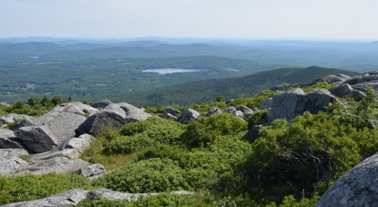
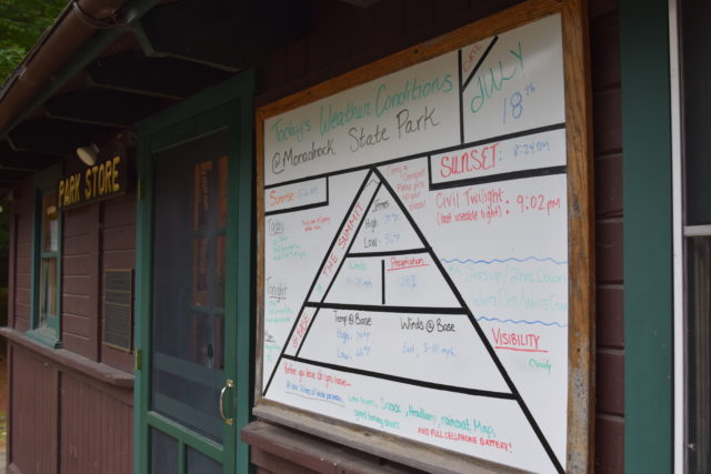
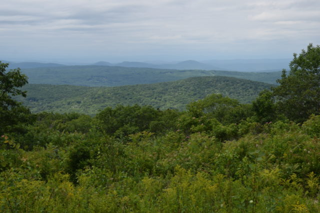
There is a whiteboard outside of the store that details the weather on the summit; it’s an awesome resource and is generally quite accurate, although the forecast can change quickly. On a typical day, it will be windier and about 10 degrees colder on the summit than at the base. It might also be foggy or wet up there even if it’s clear at the trailhead, but if it’s a bluebird day at the base, it will probably be sunny on the summit too (and you’ll definitely want to pack sunscreen).
2. Where are the bathrooms?
They are a work in progress, although they should be ready soon. At the moment, the bathrooms are the porta-potties. There are eight of them, and they are scattered around the store area and the trailhead for the White Dot/White Cross trails. The renovated bathroom building looks very nice but is not yet functional; please note and abide by any caution tape or signs. There is a water bottle filling station on the bathroom building, and that works. The water is tinged slightly yellowish red and tastes a bit like iron, but it is potable and has been tested several times; just consider it free supplemental iron along with your water!
3. Where is the trash can?
Short answer: your car. Longer answer: we don’t have any, because Monadnock is a pack-in, pack-out park. Anything that comes into the park with you should leave with you (this includes toilet paper, orange peels, and chewing gum!). The store has grocery bags you can use as personal trash bags to make it easier to pack things out. I do carry a plastic bag to pick up any garbage left on the trails, but I am not a traveling trash can, so please do not try to give me your trash too. I know that the lack of garbage cans can be frustrating for visitors. However, the park often sees over a thousand people per day coming through Headquarters, and we just don’t have the staff, dumpster capacity, or anything else to deal with that amount of waste.
4. What sort of wildlife lives in the park?
This question is typically phrased as “will I see a bear?” You probably won’t, although they are around and are seen not too infrequently. If you do see one, please do not approach it. It will likely run away, at which point you can calmly walk away and continue on your hike. If it starts to move towards you (which would be very surprising), make yourself large and make noise – black bears do not want to mess with people and will typically leave immediately.
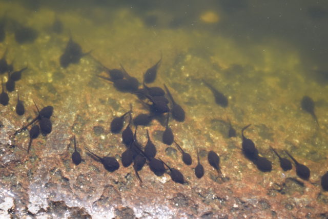
Other animals you are more likely to see include squirrels or chipmunks; tadpoles or frogs; various birds; and potentially deer, turtles, porcupines, or weasels. The tadpoles in the summit pools are tree frogs, and it has been fascinating watching them grow up throughout the month I’ve been in the park. The other animals I listed are less commonly seen, but they definitely live in the area, and it’s quite possible you will run across some of them during your hike.
5. Should I keep hiking?
Well, that depends on the sentence you said before this one. If you’re tired and sweaty, that’s pretty normal. Assuming you want to keep going and are prepared with water, some snacks, and ideally a warm layer/raincoat or other hiking necessities, by all means keep hiking. If you are feeling sick, especially overheating and feeling dizzy or nauseous, let me know, sit in the shade, and stop walking. If you’re feeling unsafe or worried about the weather, terrain, or some other environmental factor, please turn around or at least ask for advice. The last thing we want to see is someone who walks into bad weather or feels unsafe on the trails and pushes their limit too far, which leads into the next question:
6. What do you do if someone gets hurt?
This is often also phrased as “Oh, you’re here to take care of us when we get hurt, right?” No, I am not, and we always hope that everyone stays healthy and injury-free. That said, accidents absolutely happen no matter how prepared you may be, and it is part of my job to help people who are hurt or sick. In the case of an injury where the patient is stable and can walk (and I mean is physically capable of walking, shuffling, crawling, or somehow moving forward), we will try to get them down the mountain under their own power. This may be uncomfortable, and it can take a very long time, but it typically only requires one or two staff people to be caregivers and guides.
If the patient absolutely cannot move themselves, we will try to organize a litter carry. This is not comfortable for the hurt person, and it requires ideally 18 rescuers. There will be six people holding the litter at all times, and it’s hard work, so having three teams of six to swap out is somewhat necessary. Carries can be dangerous for the patient and the rescuers; maneuvering down steep slopes while holding a litter steady is difficult, particularly if it’s wet, cold, or any other sort of iffy weather, so we try to avoid this option.
Assuming that (a) there is a full-on emergency; (b) there are not nearly enough rescuers available for a litter and the patient can’t move themselves; or (c) we’re not sure this patient will remain stable for the full walk/carry down the mountain, we can call DHART, the helicopter. They are awesome and respond very quickly with the equivalent of a winged ambulance. That being said, this is weather-dependent and can be a hassle for everyone. You can’t land a helicopter everywhere, so we still have to walk/carry the patient to a landing zone; any aircraft has an element of risk; and it’s really easy for one person or one small object to make landing impossible. If any hiker is too close to the landing zone or flight path, if a granola bar wrapper flies towards the helicopter and goes into the rotors, if literally anything goes differently than planned, the whole operation can be thrown off. The helicopter may have to either abort the landing or stay grounded on Monadnock until a mechanic can drive over, hike up the mountain, and certify that it is safe to fly again.
7. How often do you climb Monadnock, and how fast do you make it up and down the mountain?
I’m at the park five days a week, so if it’s decent weather and/or there are a lot of people hiking, I’m usually going to climb at least part of the mountain. I may not summit every day, but about four days a week is fairly normal for me. We tell people that, from headquarters, it should be 2 hours up and 2 hours down for the typical group. Personally, I have never timed myself, nor do I intend to. I know I can make it up and down fairly quickly, given sufficient motivation (i.e. approaching thunderstorms), but I am definitely not trying for a speed record. If you ever see me running, there is probably something else going on, so please forgive me if I don’t answer your questions thoroughly or if I go by abruptly.
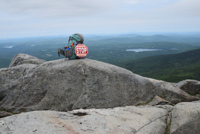
8. Why is there a stop sign on your pack?
All of us Interpretive Rangers are specifically focused on education programs, so, although I will absolutely respond to rescues, ask people to abide by park policies, and try to be a good steward of the park’s natural resources, my main goal is to chat with hikers and do education programs. The stop sign actually says “Education Programs Here: STOP: And Ask A Question.” Please do ask me questions; I love chatting about the mountain, and it’s much more fun and effective to educate people about things they are interested in, rather than just giving a pre-made program.
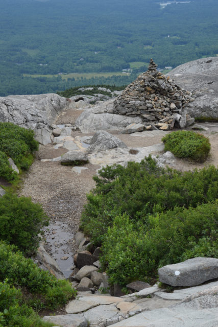
9. How do I know where the trail goes?
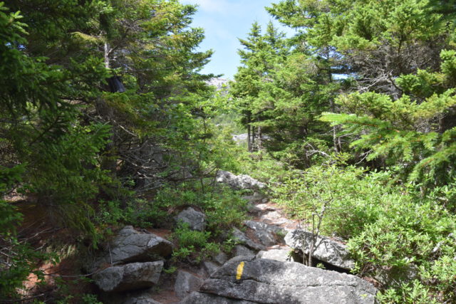
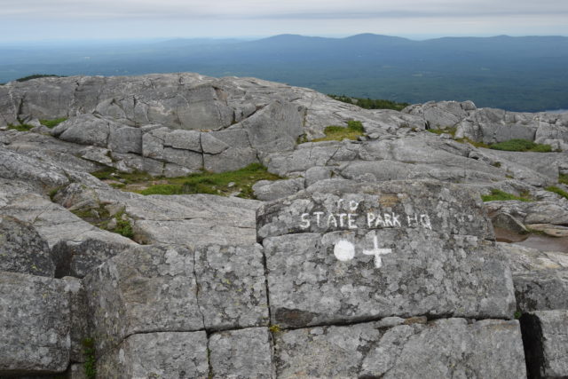
Blazes (paint on the rocks or trees) and cairns (rock piles). Each major trail is blazed slightly differently – pay attention to what your trail’s blazes look like. It can get confusing with some trail names and colours, so always feel free to ask park staff and double check that you’re on the right trail.
Once you get above treeline, or if it is a foggy or snowy day, you will be following cairns. Cairns are rock piles built by park staff members, and they mark trails. Do not modify them in any way (this includes adding a rock). For one thing, modifying cairns is illegal. It is also a major safety issue. Taking rocks away makes the cairns smaller and harder to follow. Building new cairns gets people lost because they don’t know which rock piles to be following. Adding to cairns often destroys them because you generally have to climb the structure in order to add to it, and they typically avalanche. Lastly, there aren’t that many loose rocks near the top of Monadnock, so finding one to add to a cairn may require hurting the footing on the existing trail or going off trail, which can also get you lost.
10. How do I get down the mountain?
Where’s your car? It really does make a difference. If you know where you parked and/or the name of the trail you ascended, I can point you in the right direction. As for how you physically make your way down the mountain, I’m a big advocate of sitting down and sliding. Make sure you will be able to stop before hitting any obstacles, but sometimes sitting is the safest way down the rocks. We send people who came up the White Dot down the White Cross because the White Cross avoids a lot of the steeper rock slabs and is therefore easier to navigate, but it is still steep and rocky. Definitely be careful and move at a pace where you are comfortable. Most people get hurt on the way down the mountain, so be aware of how you’re feeling and what’s going on around you.
Hopefully you’re feeling a little more informed about some of the most common Monadnock State Park queries; I’ll be hiking around with my stop sign until October, so always feel free to come visit and ask me some more questions!