Matthew Galvin – SCA NH Corps – Discover the Power of Parks Interpretive Ranger
Interested in beavers, trees, or rocks? This is the short interpretive hike for you!
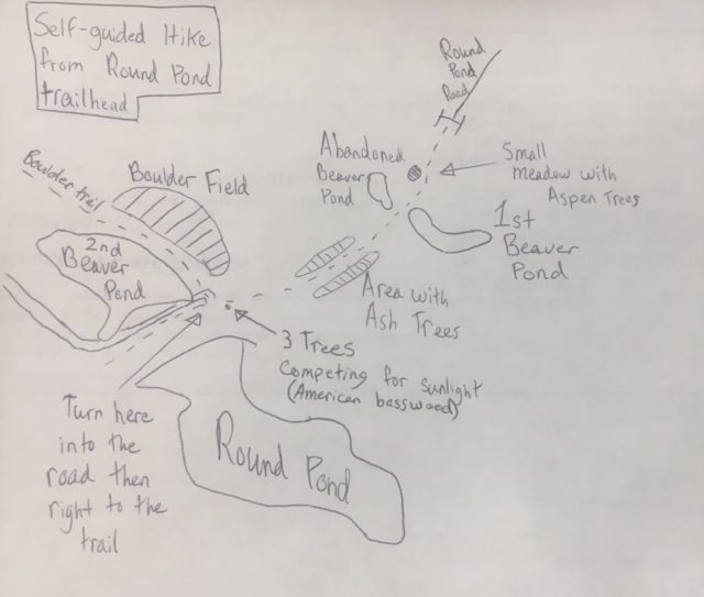
Before I dive into the specifics of the hike, I must mention that Pawtuckaway State Park has three entrances. This hike starts at the Round Pond Road entrance—one of Pawtuckaway’s two back entrances.
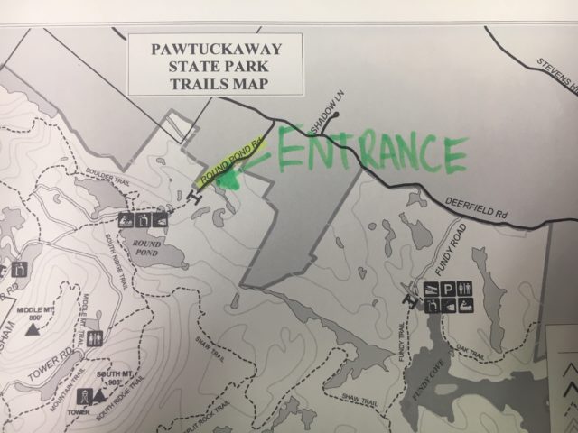
Once you have made it to the correct entrance, know that there is limited parking in the lot and no street parking. However, I personally have not had difficulty finding a parking spot. From the entrance, the trail starts at the end of the road.
As the hike begins, there will be a curve to the left in a small opening. On your right will be a few small Aspen Trees in the clearing. Look for Aspen and Birch trees throughout the hike in open spots. They are colonizer trees–meaning they are typically the first trees to establish in a recently disturbed area.
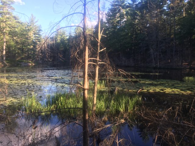
Soon after you pass the clearing, you will hit the first set of ponds. These are two beaver ponds. The pond on the right is most likely inactive (used by beavers and then abandoned) while the pond on the left is active (still used by beavers). I have seen beavers with my own eyes in the active pond. This was around 5/6pm in early August. Late in the afternoon is one of the best times to spot a beaver since they are often nocturnal and don’t come out in the middle of the day.
Besides my own cold hard evidence with my eyes, there are some more signs that they are no longer using the pond on the right.
pond die and become an easy meal or tool for building.
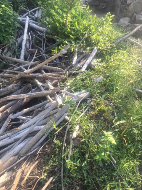
This dam is connected to the pond on the right. On active beaver dams, the water level is usually as high as the tallest part of the dam. This dam is clearly no longer maintained as much of the dam is exposed and there is not much mud interlinking the sticks (Beavers use mud as an adhesive). Because it is right next to the trail, it is also possible that this dam was abandoned due to human activity.
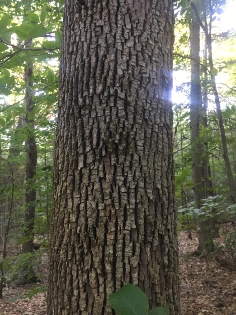
Continue down the path and there will be a straight flat section with a dry brook the trail goes over. Along this stretch (and throughout the hike) there are a few ash trees. To identify an ash tree, look for the leaf pattern and bark.
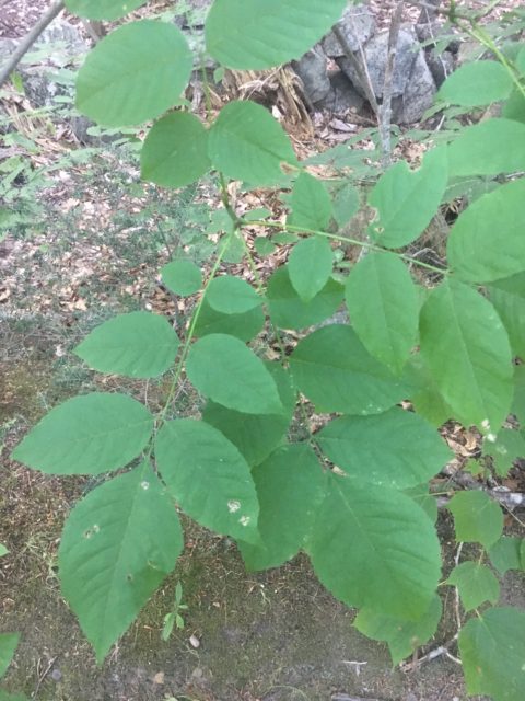
Often, in groups of seven.
Continuing down the trail, you will make it to Round Pond. At the edge of a wide drainage, three adult trees are fighting desperately to secure the sunlight for themselves.
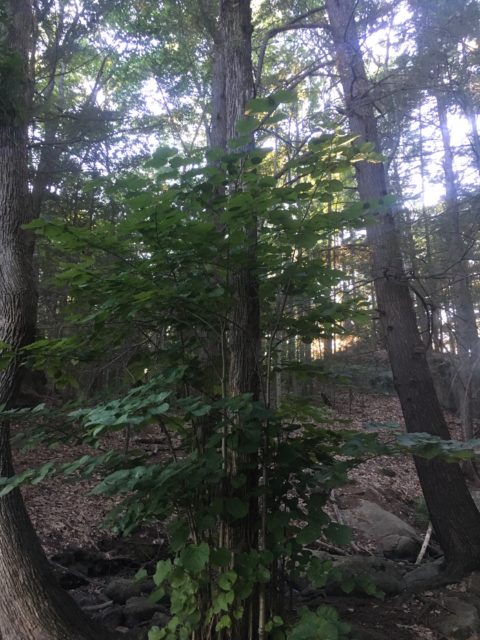
getting more nutrients from the parent tree because it thinks it might die soon.
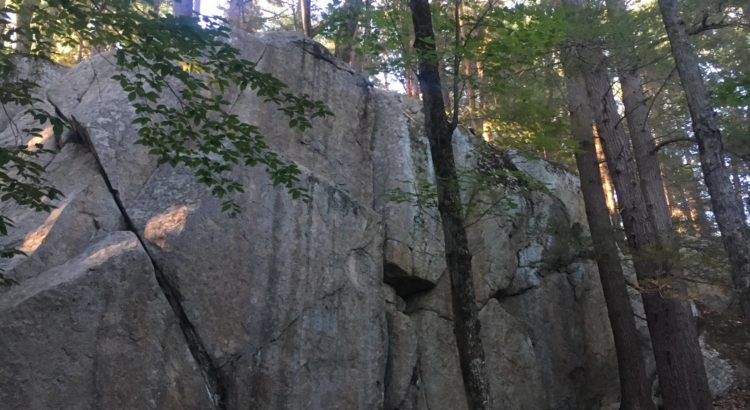
As you arrive at Round Pond, you also arrive at the Boulder Field. Even though it does not seem like it, the boulders are not jutting out from the bedrock. They are not attached to the bedrock but were actually dropped by glaciers. As glaciers expand, they actually move. The glacier that most recently covered New England moved south out of Canada, then gathered boulders from mountains as it moved over them, and dropped them when the glacier melted. These boulders or “glacial erratics” were likely originally a part of the White Mountains or the Pawtuckaway Mountains.
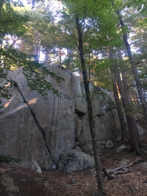
Turn the corner to the right at the road to catch the Boulder Trail, and walk to the lower slab, the area with the largest erratics that people climb on. Once you have walked the Boulder Trail for a few minutes, I recommend turning around back toward Round Pond and catching the South Ridge Trail to the Fire Tower—approximately 4 miles there and back to the Round Pond trailhead.
While you are at the state park, consider exploring the lake with a kayak, checking out the boulder field more extensively by trekking to the Upper Slab, or hiking more trails such as the North Mountain Trail. Located in the heart of southeastern New Hampshire, Pawtuckaway is a gem inside the most populated section of the state.