Located in Alton, just 7 miles south of Ellacoya State Park, a short hike up Mt. Major (1,785 feet) provides spectacular panoramic views of Lake Winnipesaukee. This hike leads up to Mt. Major State Forest which is in the Belknap Range. The loop described below is a perfect half-day hike whether you are 5 years old or 65 years old; a first time hiker or an experienced peak bagger during any season.
Mt. Major Hike Info:
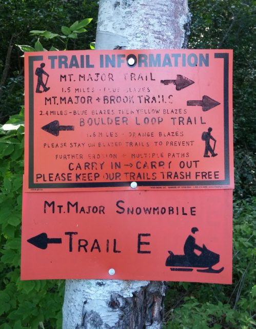
Mt. Major Trail – 1.5 miles (to scenic vista at the top, marked with blue blazes)
Boulder Loop Trail – 1.6 miles (from summit to trail head, marked with orange blazes)
Elevation Gain – Approximately 1,100 feet
Difficulty – Moderate (micro spikes are recommended in the winter)
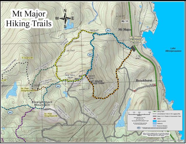
Trailhead parking is located just off of Route 11 in the Mt. Major Parking Lot. Although it is a rather large parking lot, it does often fill up rather quickly on nice summer days. Luckily, however, parking is allowed near the lot on the side of Route 11. Maps and porta potties can be found in the parking lot and the trailheads are located at the far end.
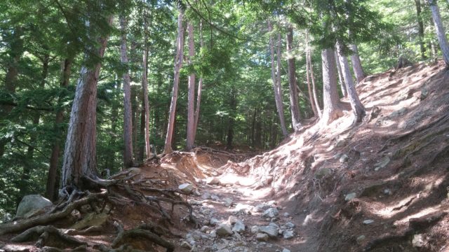
For this hike I decided to head up the Mt. Major Trail which ascends the mountain from the north side. The trail is to the right beside the bathroom area and is well marked with blue blazes. While the trail is somewhat eroded at times, it is generally easy going and not very steep for the first .7 miles.
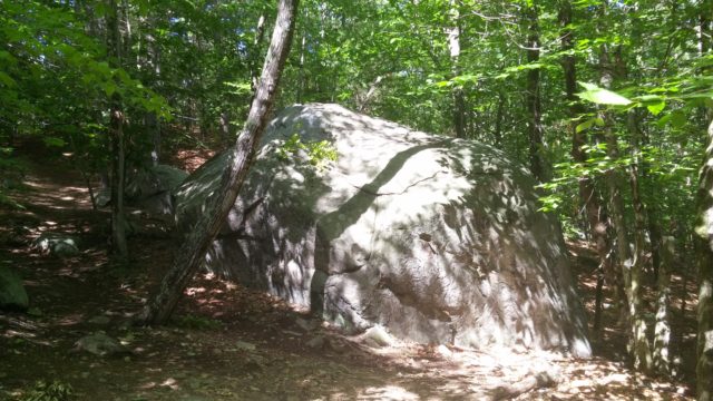
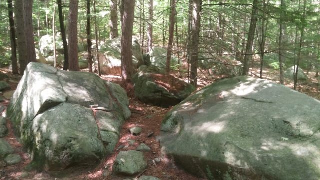
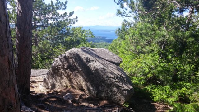
As you walk through the deciduous-dominated forest you may notice several large boulders alongside the trail known as glacial erratics. These boulders were deposited during the last ice age by glaciers about 10,000 years ago.
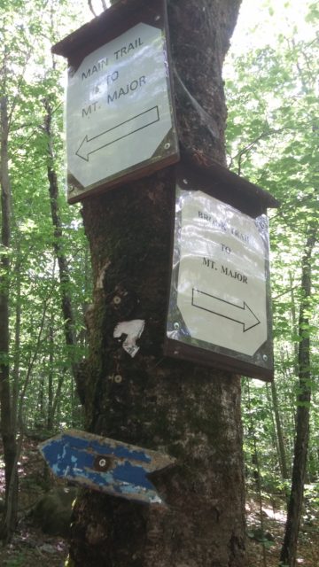
About .7 miles into the hike I reached the Brook Trail junction. At this point I took a left to stay on the Mt. Major Trail to take a more direct route to the summit.
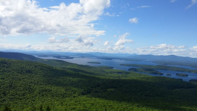
The second half of the Mt. Major Trail was a bit steeper and worked its way up some open, rocky ledges at times. As I pushed for the top, views to the north began to pop out through the trees, providing glimpses of Lake Winnipesaukee.
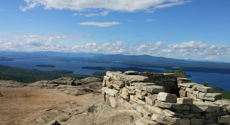
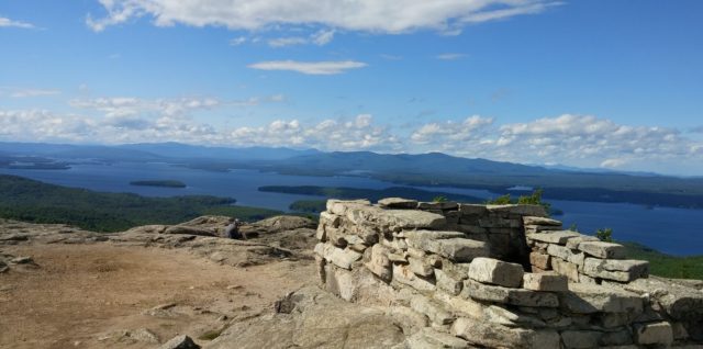
Once I reached the summit about 1.5 miles into the hike, I was rewarded with amazing views of Lake Winnipesaukee and the southern rim of the White Mountains. From the top, it is easy to see Alton Bay on the southwest edge of the lake all the way to Moultonborough Bay to the north. The summit of Mt. Major is generally quite windy, so I found refuge in the remains of the stone structure known as Mr. Phippen’s Hut which was built in 1925.
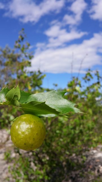
To complete the loop, I set off down the Boulder Loop Trail which is well marked with orange blazes. Along the way I stopped to take note of the wide variety of vegetation beside the trail. Some of the most common trees included Red and White Pine, Red and Striped Maple, Red Oak, American Beech, and White Birch.

As I descended back into the forest, the trail began to increase in rockiness and steepness. At times it required both hands and feet but it was overall quite easy.
With about .4 miles left in the hike I met the snowmobile trail which would take me back to the parking lot. From here on the hiking was quite easy. The trail had widened a bit and began to level out in steepness. After a short period of time I reached the trailhead at the Mt. Major Parking Lot and my wonderful jaunt up Mt. Major was complete!
I hiked today and it was nice except there were so many dogs and one of them pooped right on the trail. Very sad that people just can’t pick up after their dogs.
are dogs allowed to climb mount major?
Yes, we saw many yesterday.
Yes dogs are allowed to climb. Just please clean up after them.
yes
Brought our friends up here for their first time hike. Great day beautiful weather ….Get in early or you will walk a mile to hike your Mt.
Well marked trails 👍👍
Never mind dogs, we saw a goat with his people many years ago!
I hiked up to Mount Major today with my wife. We are both in our 60’s. I thoroughly enjoyed the hike, but my wife had reservations about the Blue trail. It was too steep for her, but she made it, I suggest that the sign at the trailhead convey that the Blue trail is much steeper than the Yellow trail. Overall, we loved the view from the top. Thank you for having so many porta-johns there. I would suggest a trash can, because some people just throw their trash down by the porta-johns.