By Nell Davis, SCA Interpretive Ranger at Monadnock State Park
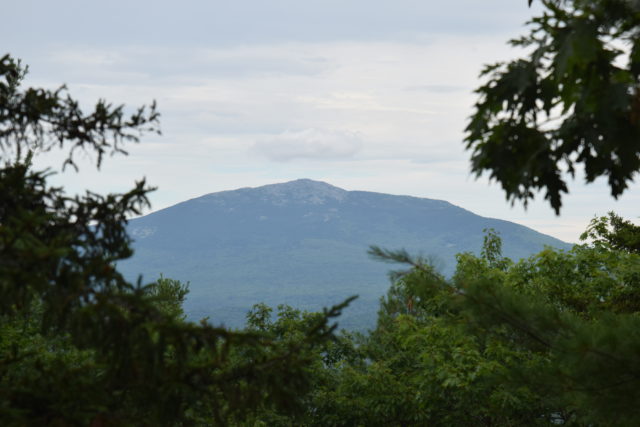
A large region of New Hampshire is named after a hill that would not even count as a mountain in many states. Mount Monadnock stands only 3,165 feet tall (plus or minus a few feet, depending on who you ask), but it is an iconic New Hampshire landmark. What do we have to thank for this wonderful mountain and state park? In large part, the credit goes to what one of my students called “the infrastructure of the earth” – geology. To understand the Monadnock that we know now, we will have to rewind quite considerably and then slowly work our way through water, heat, pressure, periods of tedium, and ice.
Setting the Scene
To begin with, let’s go way back in time. About 415 million years ago, the present-day East Coast of the United States was nonexistent. In fact, the North American continent, at this point named Laurentia, ended just East of Vermont; most of New Hampshire was under an ocean. Across the ocean was a small continent named Avalonia. As Avalonia’s land eroded, sand, silt, and mud slowly collected at the bottom of the ocean, forming new layers of seafloor that would eventually become Mount Monadnock’s rocks.
Continental Collision
After approximately 25 million years, Avalonia started to more closely approach the coast of Laurentia. This happened thanks to what is known as a subduction zone. Think of the earth’s surface as a jigsaw puzzle of large pieces of crust called tectonic plates. These tectonic plates do move around, and if two plates jam into each other, the denser one will often dive under the less dense one, allowing the plates to continue to converge. This process forms a subduction zone, and subduction zones are a major player in landmass movement and global geology.
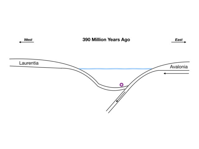
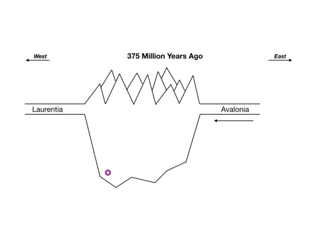
In the case of this particular subduction zone, Avalonia eventually collided with the land on the coast of Laurentia, slowly squeezing the landmasses together, forming tall mountains while compressing the rocks that are now Mount Monadnock. Continental collision is how the Himalayas are being formed today; as the Indian subcontinent pushes into the rest of Asia, mountains are forced upwards.
At this stage, it is important to understand that mountains and icebergs are very similar. What I mean is that mountains have deep roots extending below the Earth’s surface, just as icebergs extend well below the surface of the water. All of the rocks stuck in the middle of a continental collision are under intense heat and pressure, but this is particularly true for the sediments buried in the roots of mountains.
Mineral Evidence
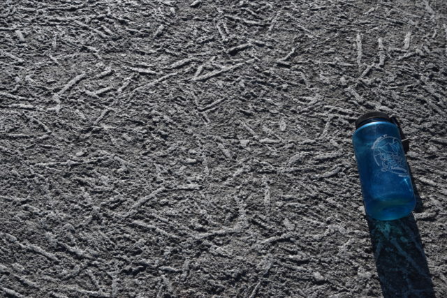
Two minerals present in Monadnock’s rocks are sillimanite and garnet. Both of these minerals form under specific heat and pressure conditions, and their presence tells scientists that Monadnock’s rocks were at one point during the Laurentia-Avalonia collision buried at least 12 kilometers (about 7.5 miles) below the surface of the Earth. Today, sillimanite is especially noticeable on the mountain, where it forms “turkey track” patterns. These designs show up because sillimanite is a particularly durable mineral that now stands a bit above the weathered surface of the larger rock slabs.
Folding
Not only were Monadnock’s former seafloor sediments buried deep below the surface of the earth and compressed into rock; the layers were also deformed during the Laurentia-Avalonia continental collision. Think about laying a ream of paper on a table and pushing the edges horizontally towards each other; the paper will soon buckle under the pressure. Layers of rock do the same thing, especially if they are hot enough to be malleable. In the case of Monadnock, all of the nice flat layers of mud, sand, and other seafloor sediments were pressed down into the earth, heated up, and accordion-folded as Avalonia and Laurentia continued their slow-motion collision.
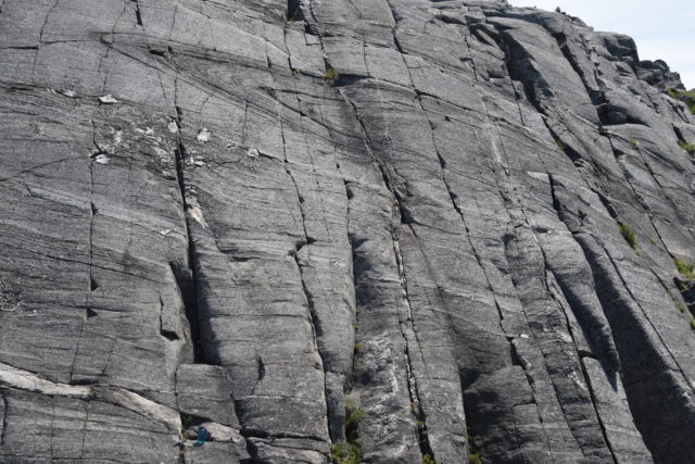
Erosion
Over a long time (and a long time geologically is an extremely long time in everyday terms), many things changed. All of the land in the world, including Avalonia and Laurentia, joined together to create a supercontinent named Pangea, and the large mountains overlying Monadnock’s rocks started to break down and erode away. As this erosion continued, Pangea broke apart into today’s continents, not quite following the earlier continental lines (part of Massachusetts is much more closely related geologically to Europe and Africa than to the rest of the United States, as it was originally a part of Avalonia).
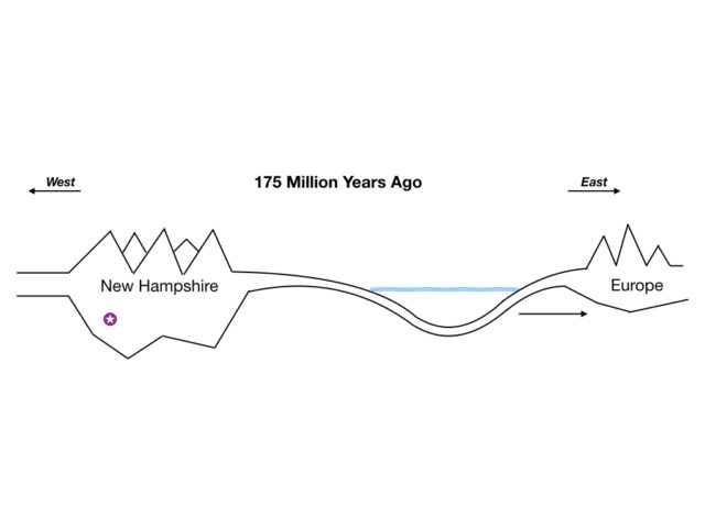
Throughout all the land changes, the tall mountains continued to erode away, meaning the buried rocks that now form Mount Monadnock moved closer and closer to the surface. When these hard rocks reached the surface, they eroded more slowly than surrounding rocks. The two main rock types that make up Mount Monadnock, schist and quartzite (formerly mud and sand), are more resistant than the bedrock underlying Jaffrey, Dublin, and other local towns. Therefore, the mountain stands higher than its surroundings, just as sillimanite stands up on a small scale to form “turkey tracks.”
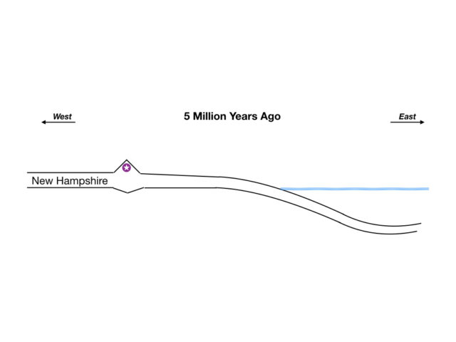
Glaciers & Today
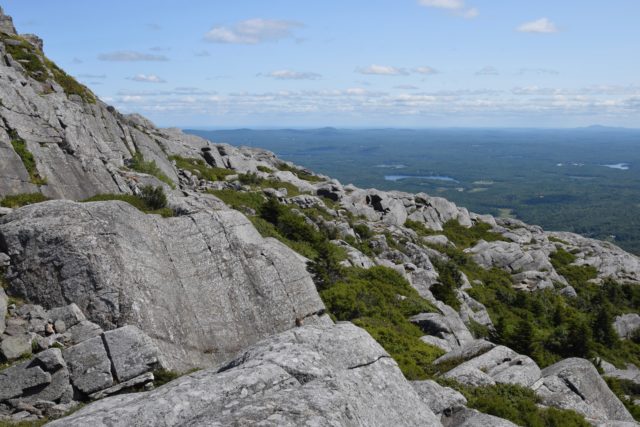
The most recent major geologic influence to shape Mount Monadnock happened only a few thousand years ago. During the Ice Age, large sheets of ice moved down from the North, slowly working their way up and over the mountain. As they progressed, they smoothed out a sort of ramp on the Northern slope of Monadnock. Looking at many of Monadnock’s bare bedrock areas, you can see gouges known as “glacial striations” running North-South, left behind from when smaller rocks were dragged underneath the glaciers and across the mountain.
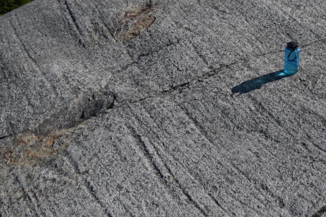
Cresting the summit, glaciers plucked blocks of rock off the South side of the mountain, carrying them away and leaving behind a steep slope. If you have ever hiked the Dublin or Pumpelly trails and compared their steepness with that of the White Dot or White Arrow, you have a very personal understanding of how glaciers impacted the present-day shape of the mountain.
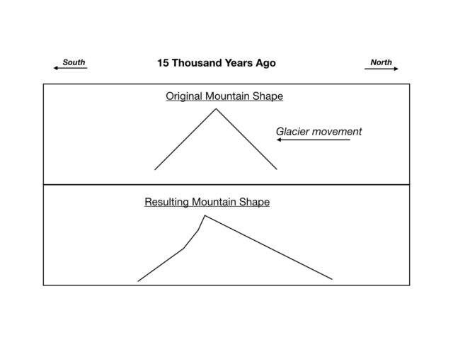
About 15,000 years ago, the glaciers left the mountain in essentially its current shape, and now we humans are probably the most potent geological force acting on Mount Monadnock as we create new trails, modify old tracks, wear down the rocks with our boots, and generally remodel the landscape.
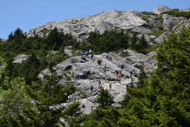
Thanks to its erosion-resistant rocks and immediately recognizable profile, Mount Monadnock is an iconic landscape feature in Southern New Hampshire. This small hill has had an outsize influence on not just New Hampshire but also on the study of geology in general; the term “monadnock” is now used to mean any erosion-resistant mountain that stands alone, and some of Mount Monadnock’s more eye-catching rocks have been prominently featured in geology textbooks. Next time you take a hike, make sure to keep an eye out for some evidence of Monadnock’s transformation from seafloor to accordioned roots of tall mountains to a hill buried in ice to the “wise old giant” (Rudyard Kipling) we know and love today.
Many thanks to Dr. Peter Thompson for his help in proofreading and fact-checking this blog post.

Really really an interesting post and I thank you for doing so! It’s a beautiful treasure formed by a lot of tugging and pulling. I’ve seen those Turkey scratches and always assumed they were from crampons worn during the colder seasons. Silly me! Thanks again, Nell! Great job!
Thank you for this! Very informative (but who was around to name the continents at that time? lol) You left out a large part as to why Mt. Monadnock is openly bare at the top, exposing the rock foundation! I think the history of the burning kind of ‘tops off’ the geological processes. You should keep going with Monadnock’s story!
This was a very interesting report. It had a lot to say. When I think of all the different layers and Turkey tracks. Yes!