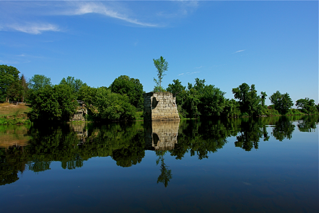
Bedell Bridge State Historic Site – July 28, 2011
Rising above the water in the Connecticut River, right on the border of New Hampshire and Vermont, the ruins of the Bedell Bridge still stand commemorating what was once the second longest covered bridge in the United States. Destroyed by heavy winds in 1979, all that remains now of the bridge is the big stone column in the center of the river that once marked the midway point of the passage.
Today the Bedell Bridge Historic Site sits behind a large private farm down a dirt road where the New Hampshire Fish and Game maintains a public boat ramp. I pulled up here to launch my kayak early in the morning to find amazingly flat water under a thick cover of low gray clouds.
With no one else in sight I paddled away from the shore and headed upriver. It was so quiet that I’m sure the only noise around was the sound of my kayak as I easily carved through the center of the big wide river. I kept paddling upriver around a large bend before I realized the clouds had completely worn off, and the sun was shining through bright blue skies.
Turning my kayak around I pointed straight for the old stone structure of the former bridge. From a ways down river, standing by itself the single column looks eerily out of place, sticking straight out of the water with a lone juvenile tree growing out of the top.
Paddling back I noticed that with the sun out the river seemed to come alive. Fish were rising to feed on insects and birds began to swoop down close to the river using that extra sunlight to spot their underwater prey. I was happy to see the sun too, and ditched my kayak back at the boat ramp for a dip in the water before heading out.
[photospace]

