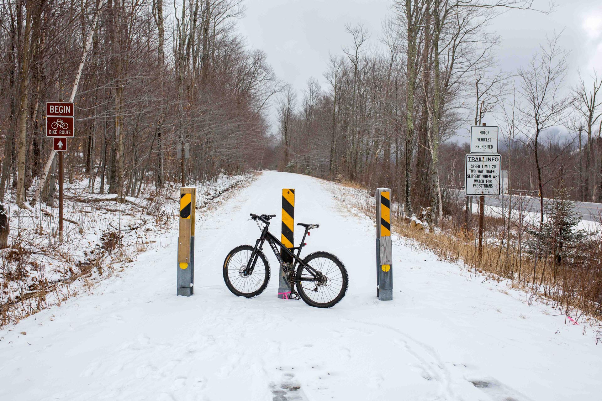
Biking down the Franconia Notch Bike Path is one of the best ways to see the natural wonders and attractions of the notch – while getting some much needed exercise. The paved bike path runs from Skookumchuck Trailhead all the way down to the Flume Gorge Visitor Center, passing Governor Gallen Memorial (Sunset Bridge), Echo Lake Beach, Old Man of the Mountain Historic Site, Cannon Mountain Aerial Tramway, Lafayette Place Campground, and The Basin. Along the way there are plenty of mountain views and the trail follows the Pemigewasset River for much of the way. Several bridges, highway underpasses and picnic areas offer additional points of interest. From end to end the trail is about 9 miles, so you might want to arrange for a pick-up or drop off at one of the points if you aren’t up for the full 18 mile down and back ride.
Franconia Notch Bike Path – Trip Details:
Parking: The trail starts/ends at the Skookumchuck Trailhead (exit 35 off 93) and the Flume Gorge Visitor Center (exit 34A). You can also access the bike path from many of the FNSP attraction parking areas including Echo Lake Beach, Cannon Tram, Profiler Plaza, Lafayette Place and The Basin.
Distance: 9 miles (one way) or 18 miles for the complete down and back.
Elevation Gain: 642 feet
Difficulty: Moderate (difficulty really depends on how much distance you want to do). The bike path is paved, flat doubletrack, however there are some hills to climb/descend that can be moderately challenging. Riding the route northward will be more uphill and riding the route southward is more downhill.
Maps: Franconia Notch State Park Hiking Map | Map of FNSP Attractions
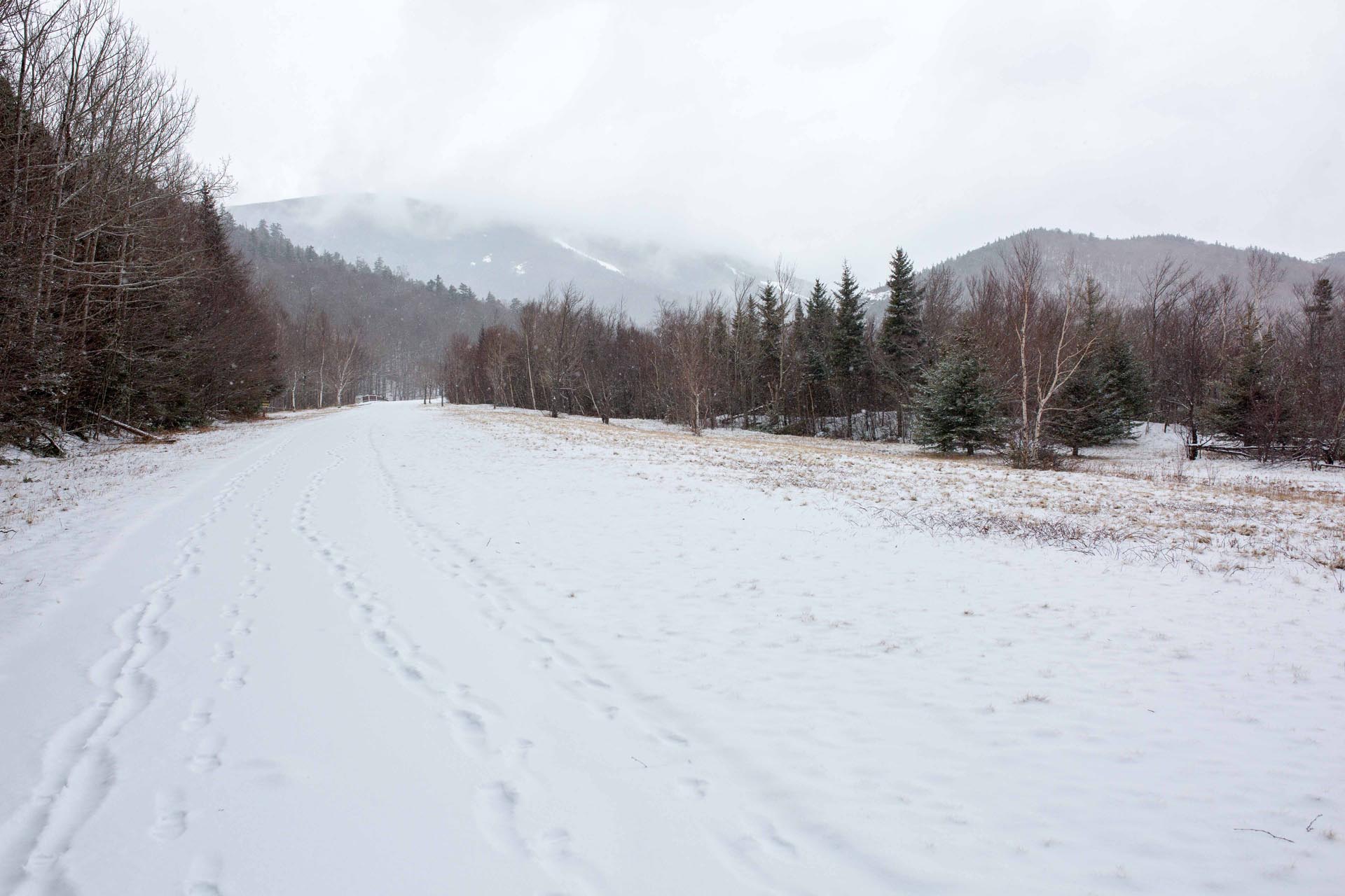
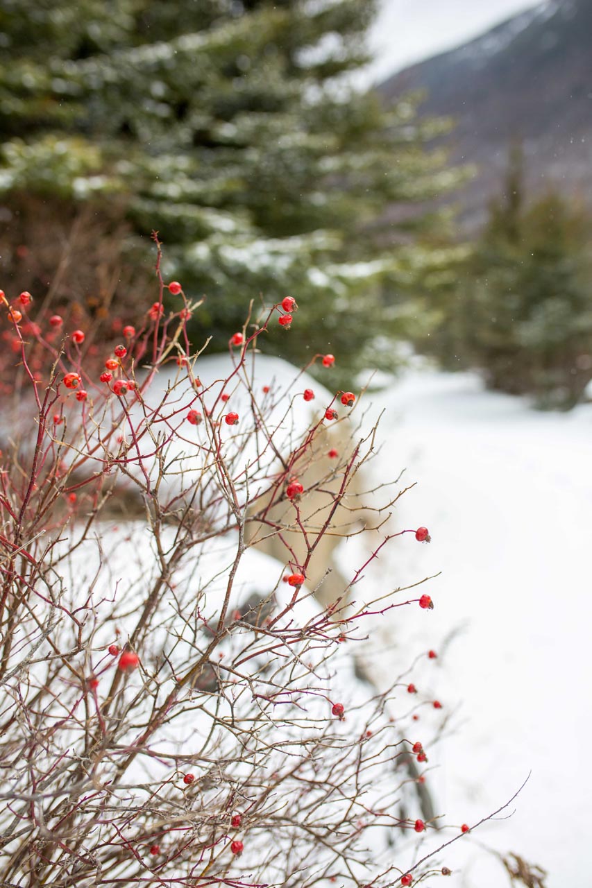
I started at the Skookumchuck Trailhead off of exit 35 and rode the path southward. I had heard that the bike path was pretty much clear of snow/ice and ready for biking, however, on the day of my ride, I arrived to find 3 inches of fresh snow and flakes still coming down. Besides the newly fallen snow, the trail seemed to be pretty clear and ok for riding so I decided to go for it.

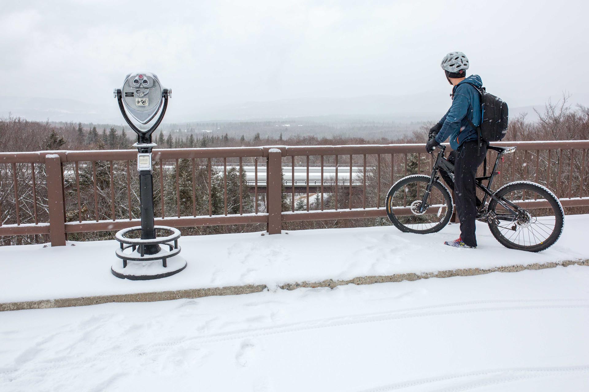
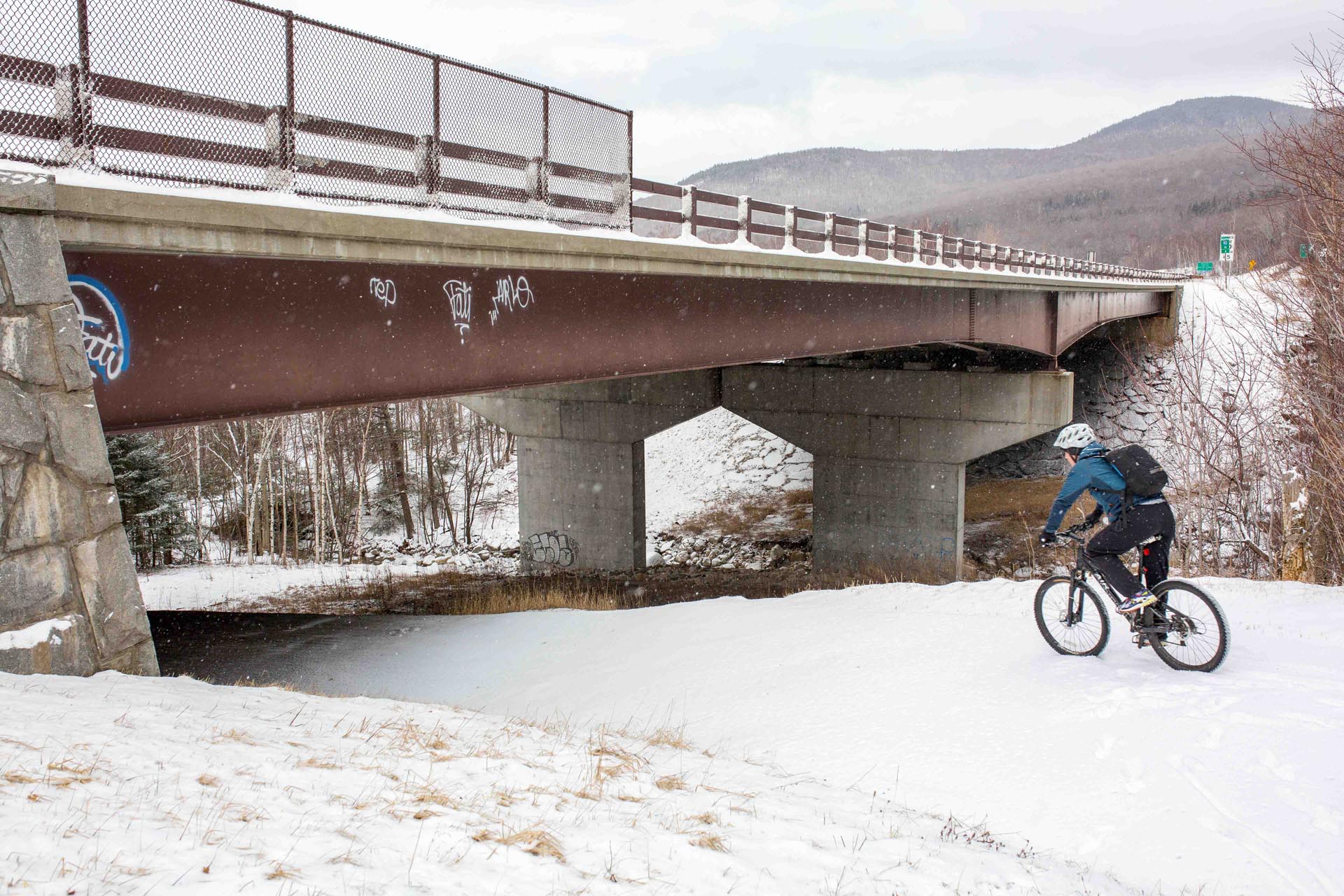
The trail starts out pretty flat with a few gentle downhills. It passes over Skookumchuck Brook before reaching stop #1 – Governor Gallen Memorial (Sunset Bridge). Here, there are some excellent views of Mount Lafayette and down into Lafayette Brook. From the bridge you can look down over 1-93 and some coin operated binoculars offer a magnified view of the mountains to the northeast.

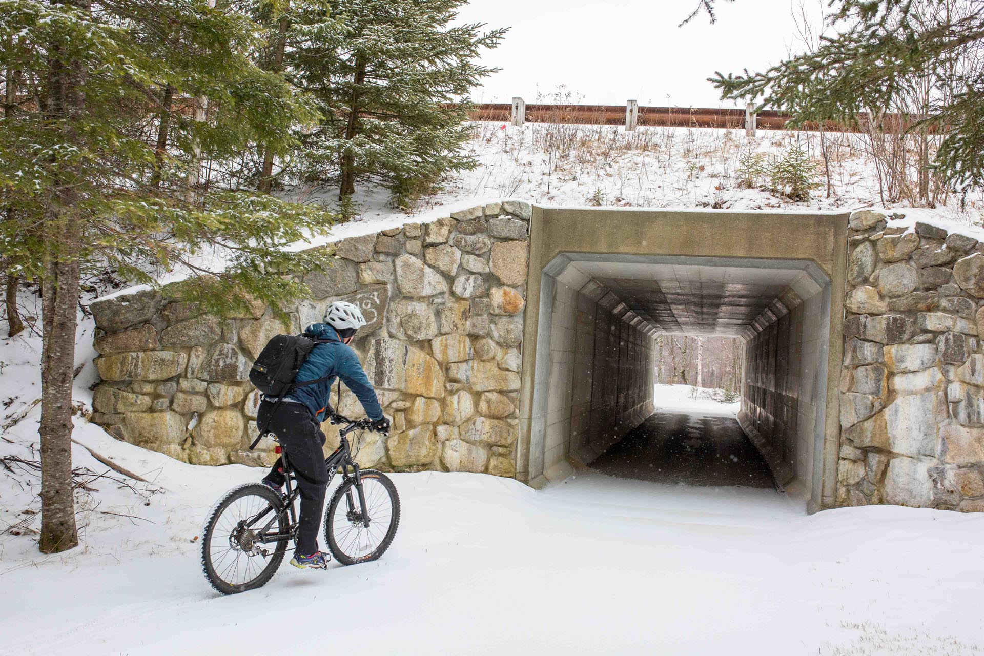
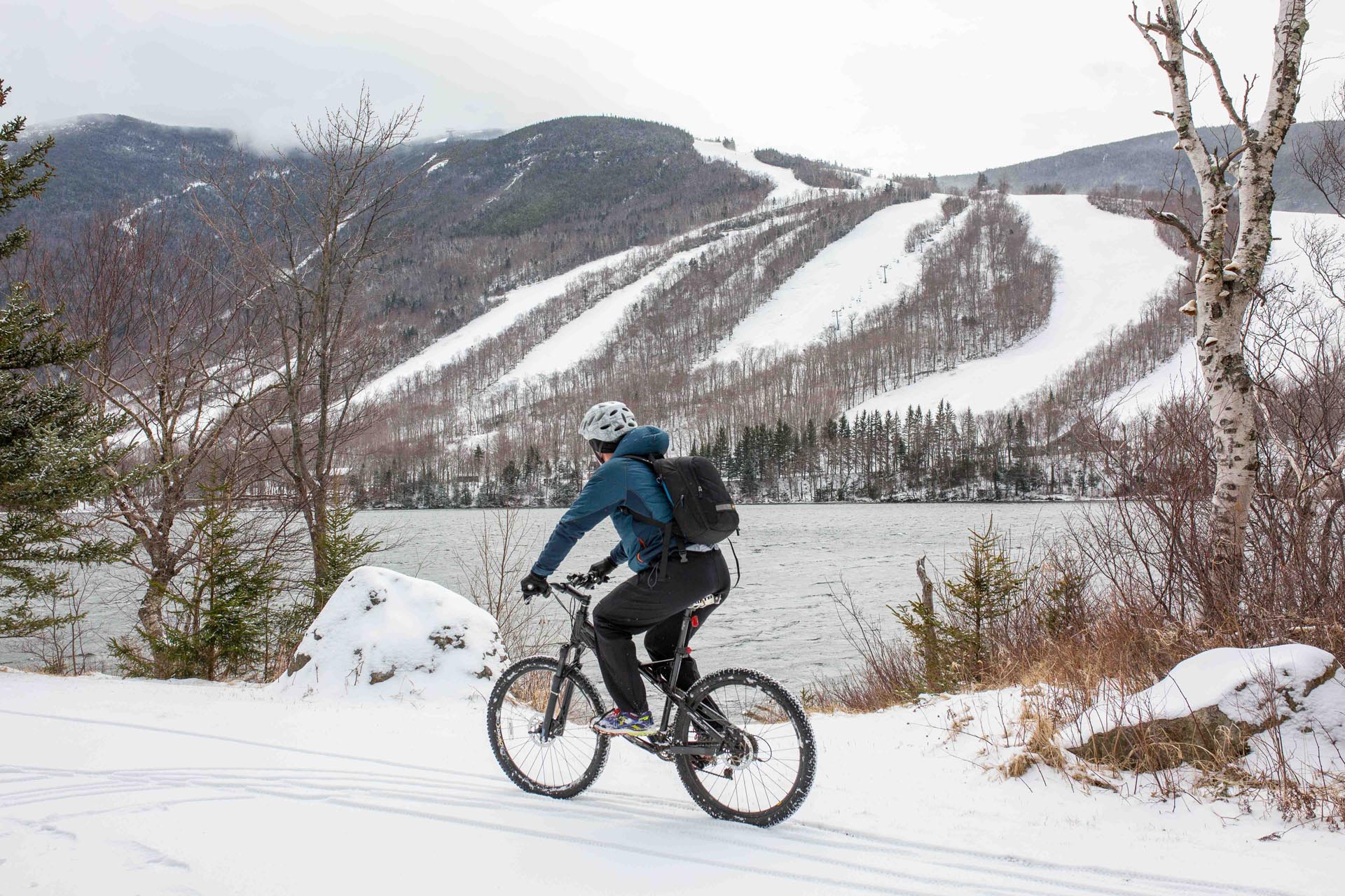
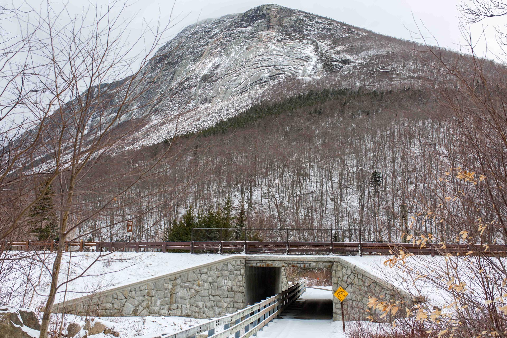
Bear right after the bridge and follow the bike path as it travels under the highway. Soon you’ll see the slopes of Cannon Mountain in front of you and the rocky face of Artists Bluff on the right. After a gradual climb you’ll go through a neat little underpass tunnel beneath Route 18 and come up quickly to Echo Lake. You’ll see the beach area on your right and get some excellent views of Cannon’s ‘Front 5’ trails as you continue alongside Echo Lake.
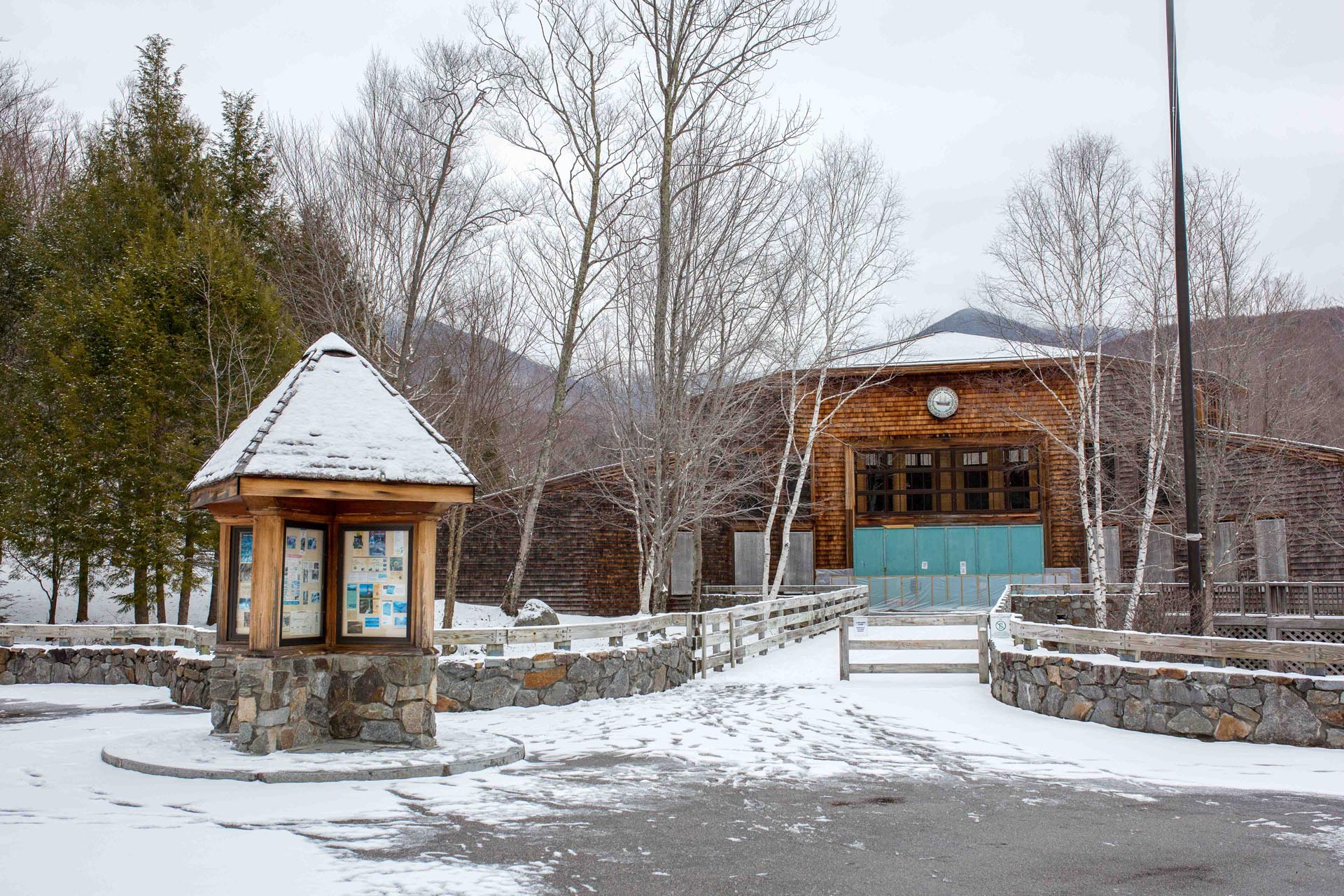
After you pass Echo Lake, the trail comes up next to the highway and then crosses the road at the entrance for the Cannon Mountain Aerial Tramway. The New England Ski Museum is right next door to the Tram and has some incredible old films, photos and artifacts telling the story of our alpine heritage if you have time for a quick stop.
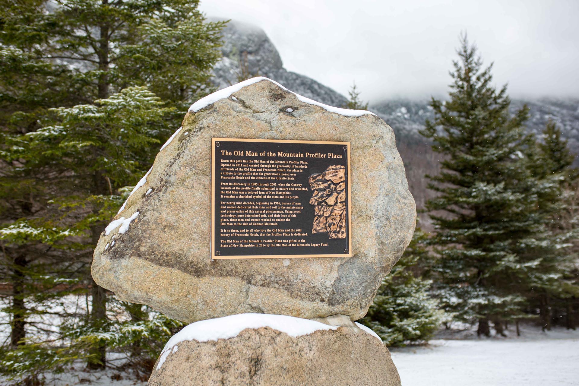
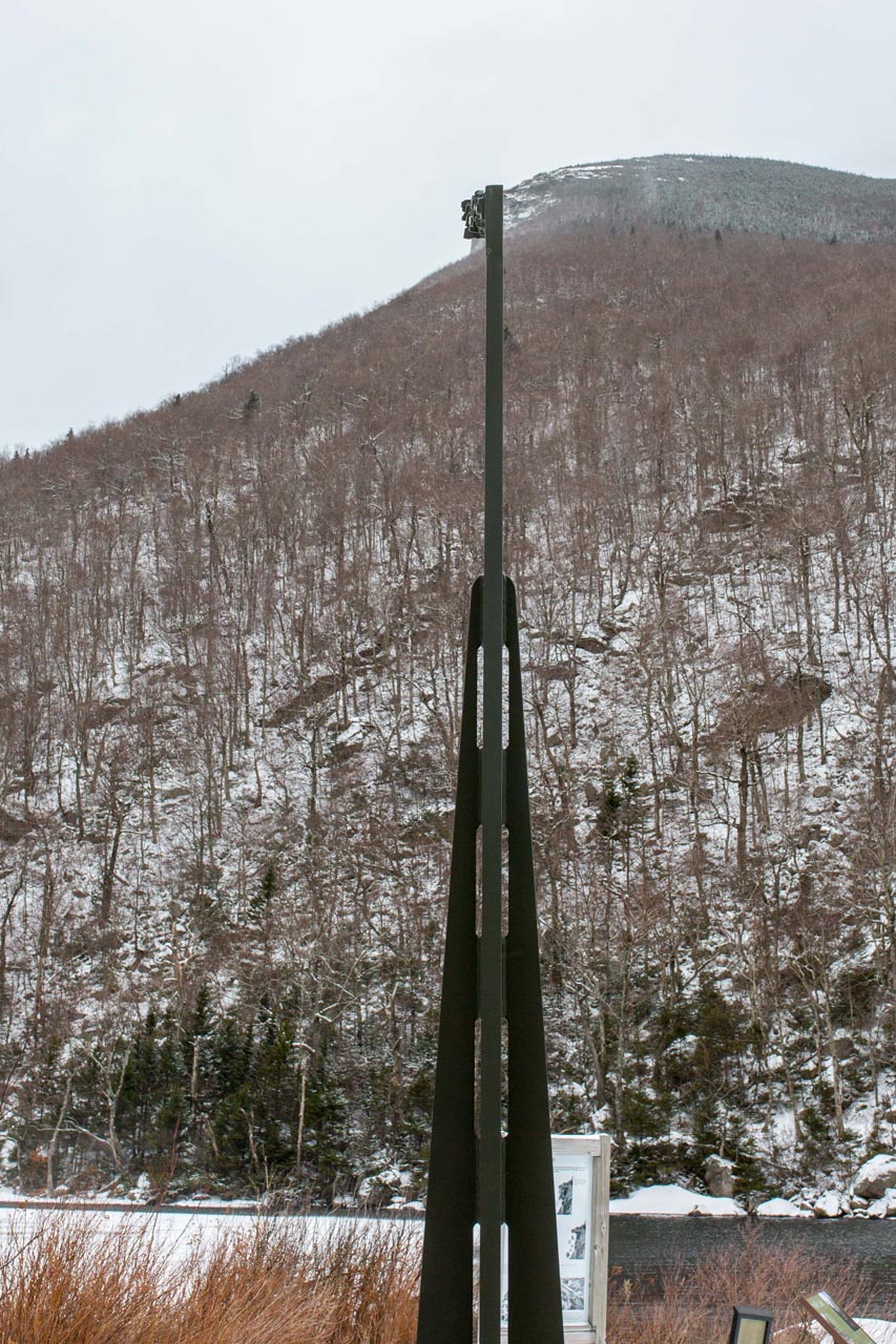
After passing the Tram you’ll quickly arrive at the Old Man of the Mountain Historic Site. The bike path actually turns left and goes through another highway underpass just before Profile Lake, but I’d absolutely recommend walking down to Profiler Plaza to see where the Old Man once stood and check out the installment of viewing columns that re-imagine what the view used to be.
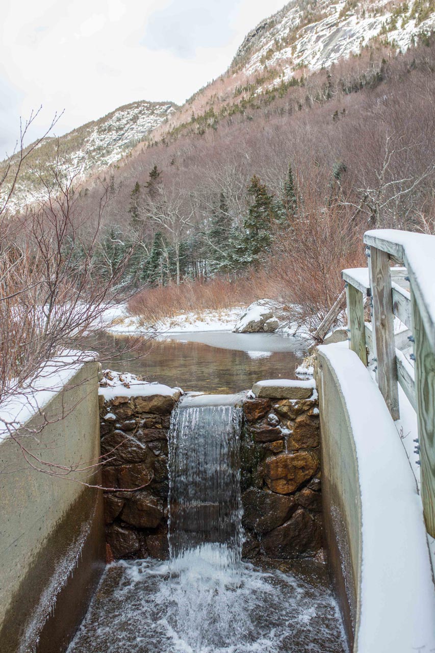
On the other side of the highway underpass is a little cascade and pond with some more views across the highway of the Cannon Cliffs. The trail enters the forest, passes over a bridge and some rolling hills and then veers right again and back underneath the highway.
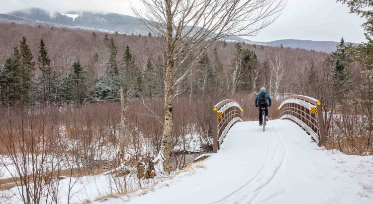
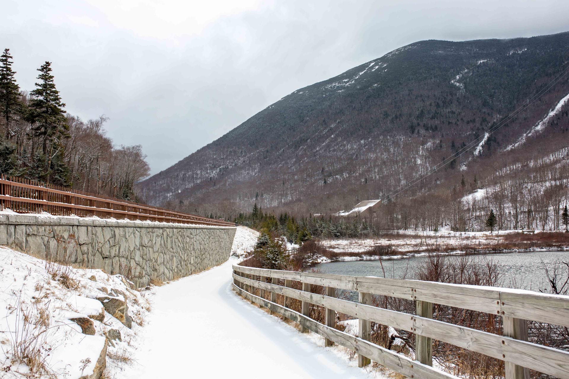
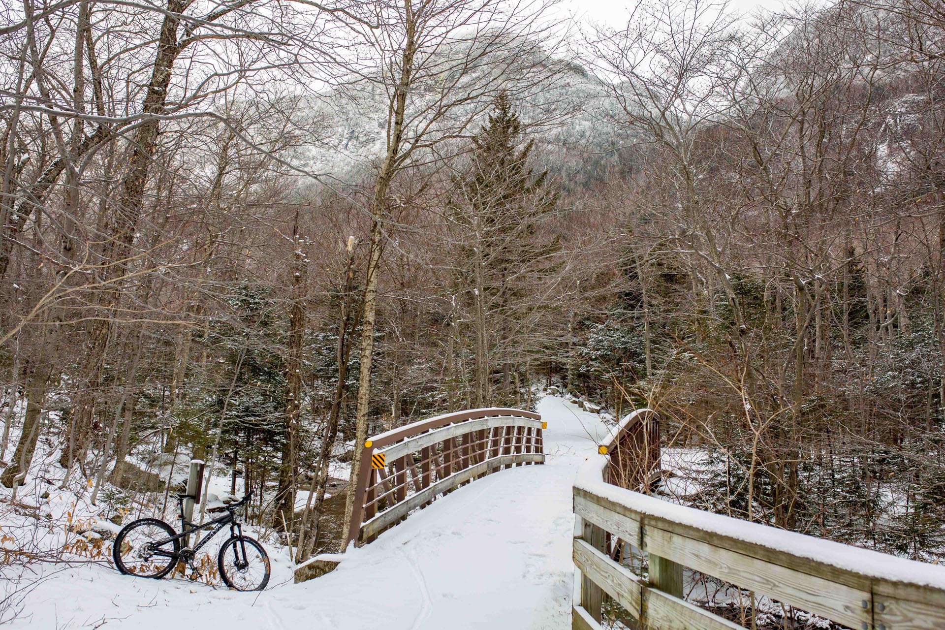
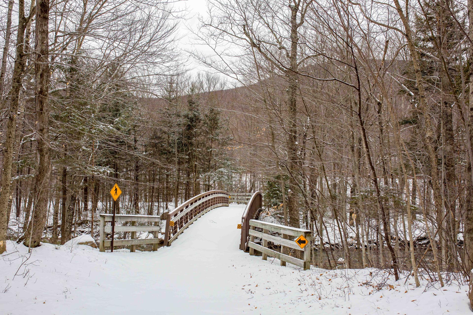
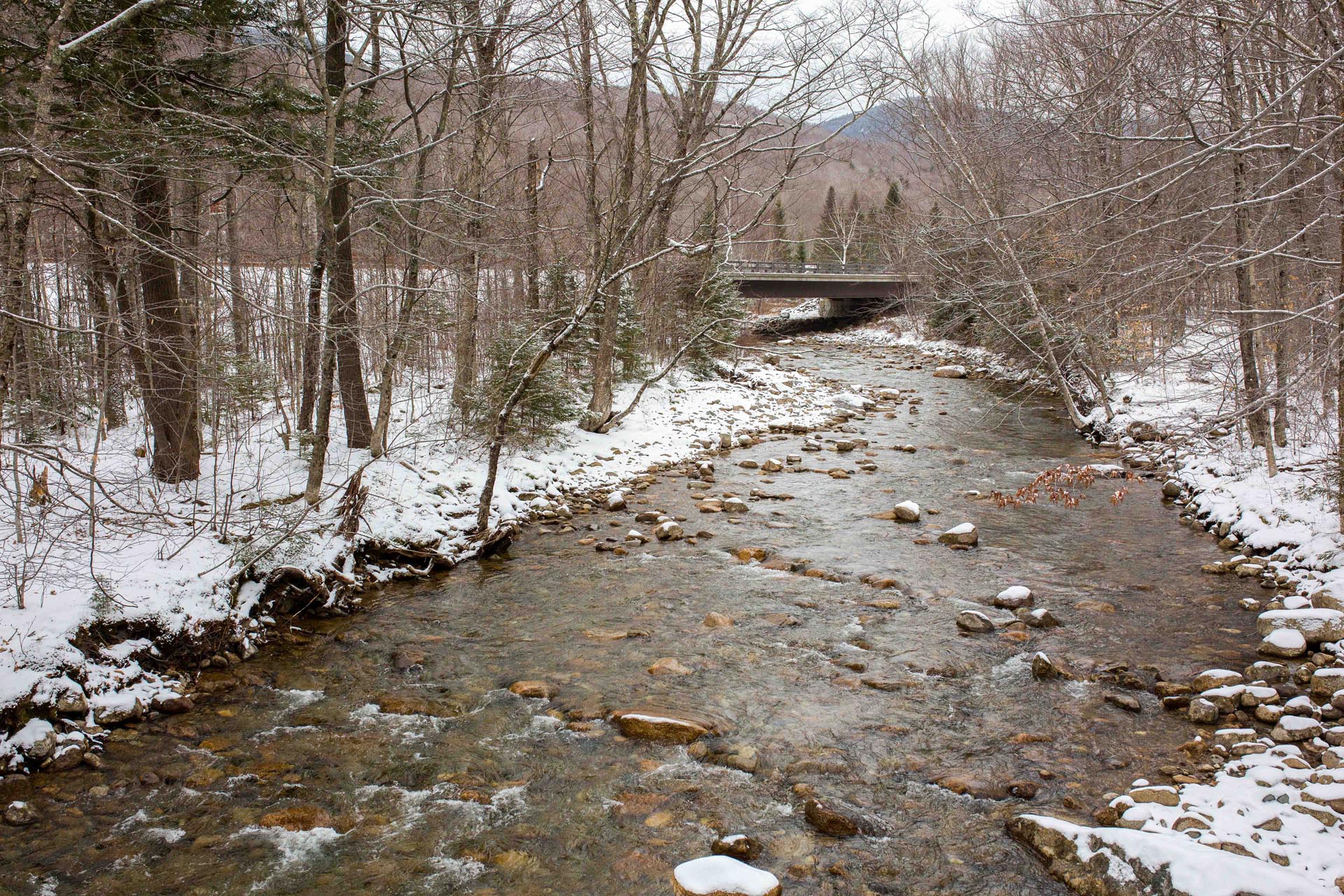
As you come out of the underpass tunnel you’ll see Profile Lake to the right. The bike path heads left, crossing the Pemi Trail and another bridge over the Pemigewasset River. It enters the woods again and travels up and over a few rolling hills for another mile and a half before coming to another really cool bridge. This was one of my favorite spots of the trip. As the trail comes out of the woods, it enters a clearing where there are some excellent views across to Mount Liberty, down into the small stream, and then back towards the Cannon Cliffs after you cross.
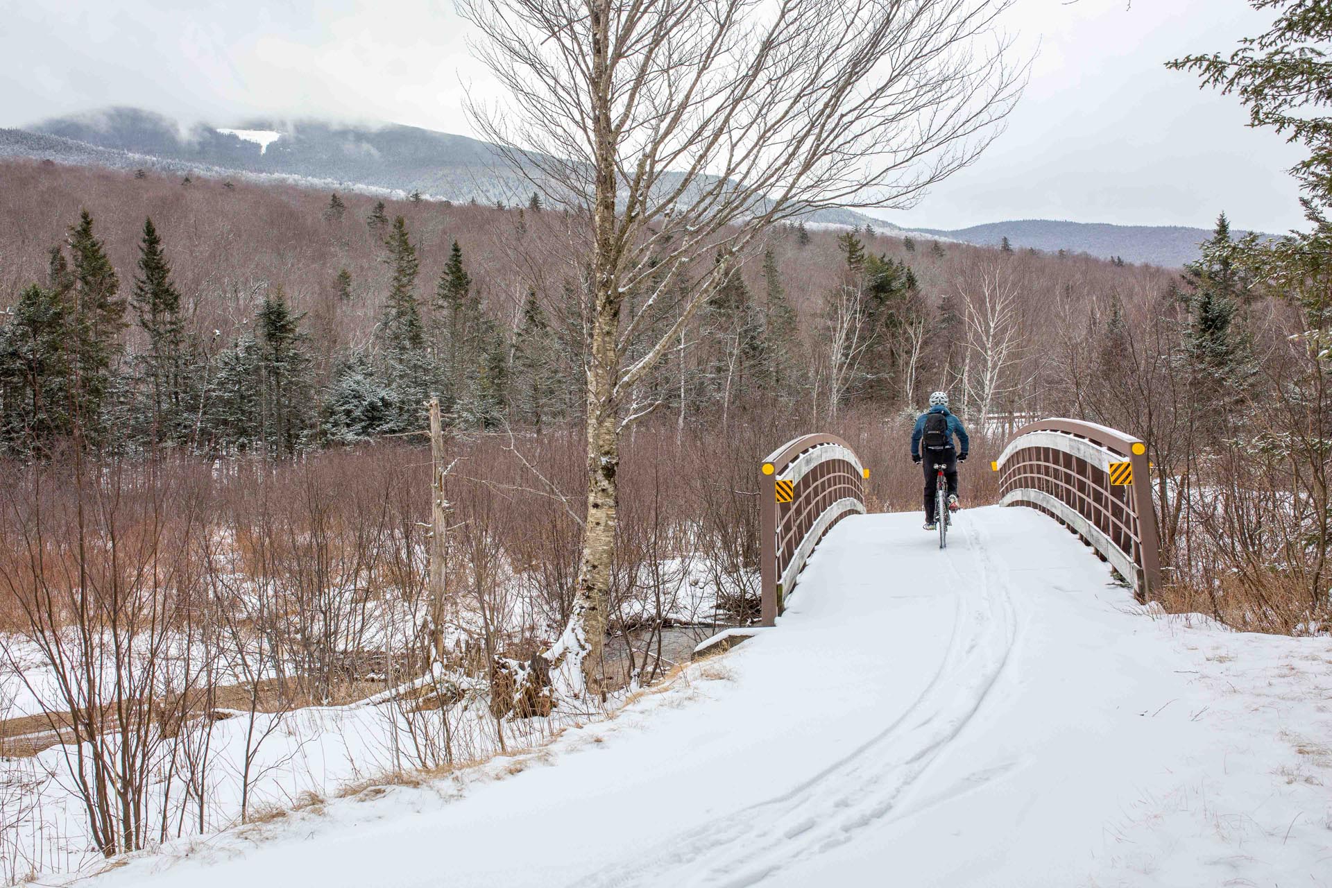
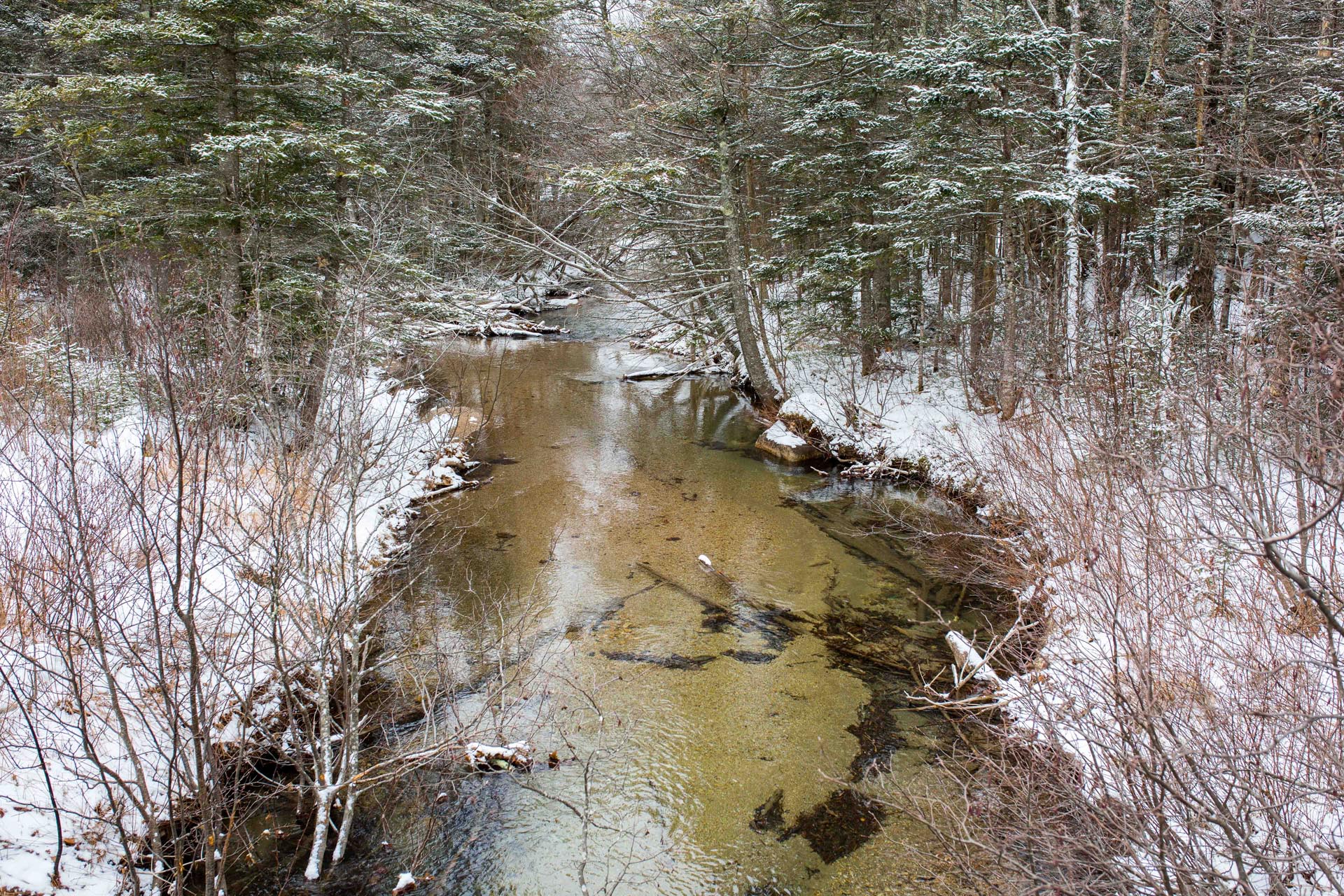
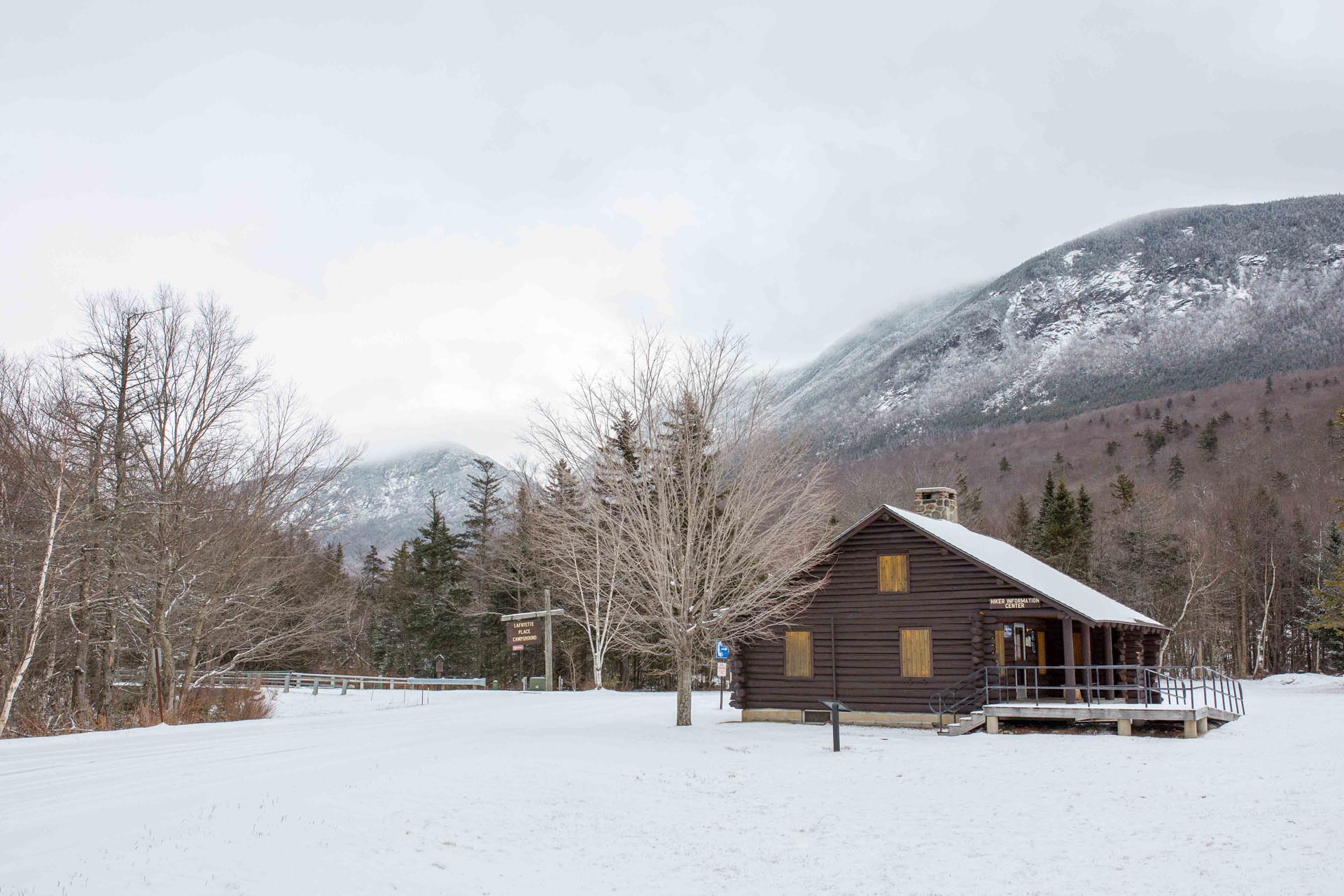
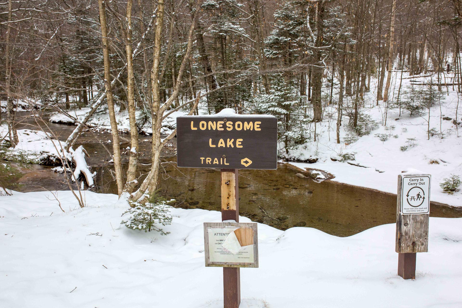
Lafayette Place Campground and the Hiker Information Cabin are just a short distance after the bridge. The bike path then continues along the edge of the Pemigewasset River after the Lonesome Lake Trailhead. I really enjoyed this section of the trail too as it closely follows the Pemi and you can see the river through the trees. I was tempted to stop and walk down to the water several times for photo opps.

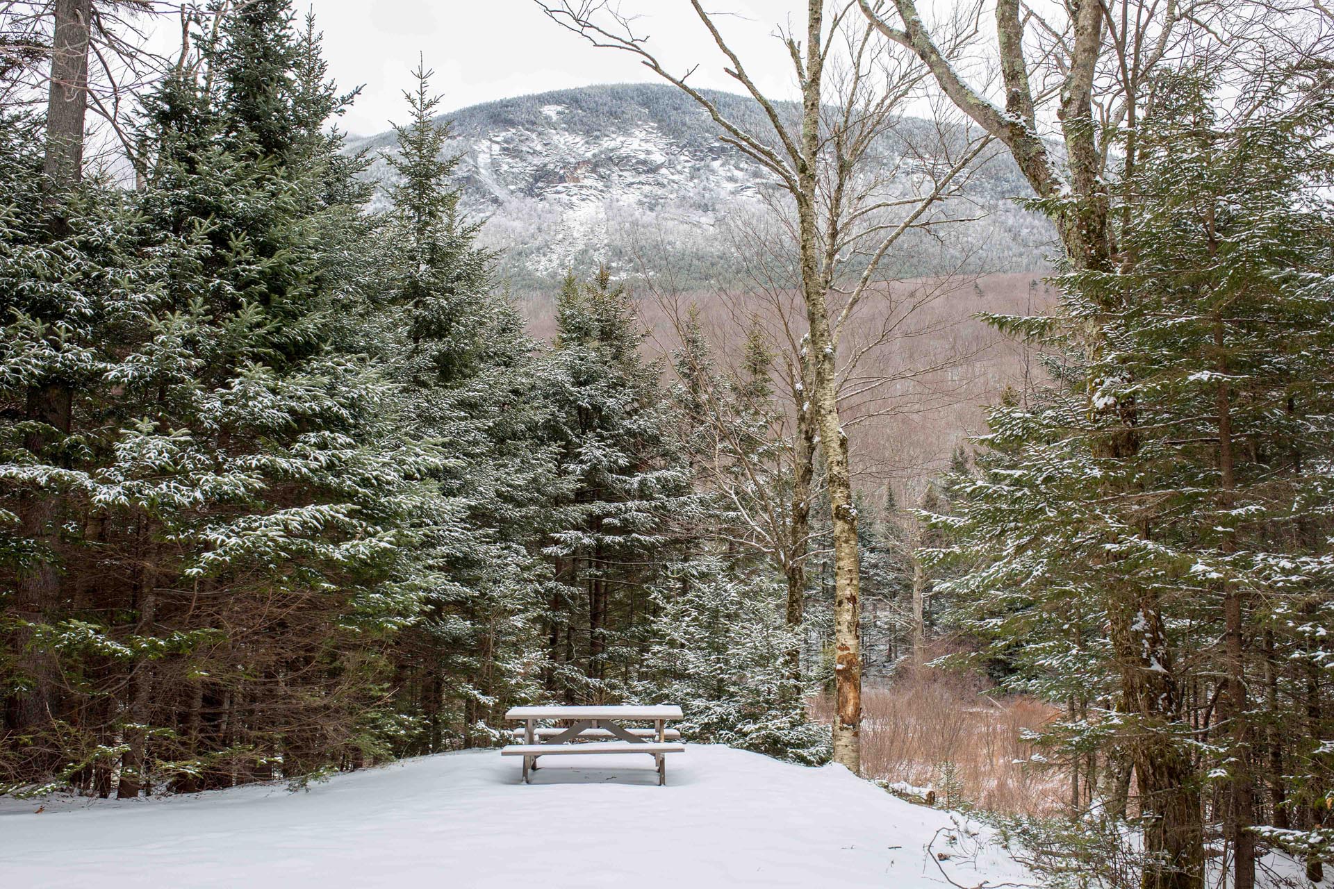
Another 2 miles down from Lafayette Place you’ll come to The Basin. There is a little trailside pull-off spot to view the Basin right from the bike path, but you may also want to spend some additional time here walking down the trail to check out all the amazing rock formations and cascades this area affords before continuing your ride.


The bike path stays next to the river for about another 1/4 of a mile before dipping under the highway again and continuing southward towards the Flume. It is another 2 miles down the trail to get to the Flume Gorge Visitor’s Center and the trail climbs and descends a few more hills in this section.
This section felt longer than 2 miles – perhaps due to fatigue setting in. There are a few more small bridges, including another really interesting one back over the Pemi as well as some other interesting spots in the woods to stop for a snack and some water before finally arriving at the Flume Gorge.
Once you get to the Flume Gorge Visitor Center you may want to take the extra time to walk up see the gorge. Bear in mind that you still need to travel almost 9 miles back up to your car – unless you planned ahead to have someone pick you up (or drop a second car). The tentative opening date for the Flume Gorge is May 8 (this is a fee area so keep that in mind if you want to walk up after that date).
I was rather tired by the time I reached the Flume Visitor Center and in need fuel/water before the haul back up the trail northward. When I come back this summer, I think I will plan for a pick up or drop off at one end of the trail so I could spend more time at each of the Franconia Notch State Park attractions.
One of my Wife & I’s favorite bike trails in the summer & fall.
This is a great bike path. Never done it in the snow, however.
Just did this ride. The foliage is barely starting t turn colors. Awesome trail with great views.