By: Lee Dudek, Interpreter at Pawtuckaway State Park
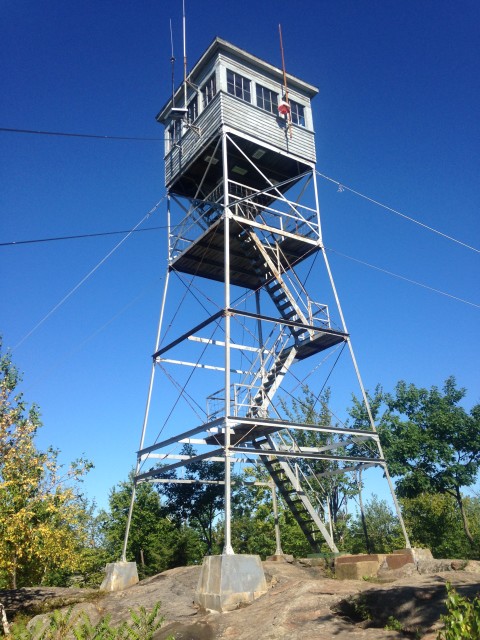
After a year of renovation and rebuilding, the fire tower on Pawtuckaway’s South Mountain is once again open. The tower was closed all of last summer and fall in order to remake the top, or cab, of the tower. Now completed, the cab is able to accommodate a fire warden who will be keeping an eye on the surrounding forests for any signs of fire.
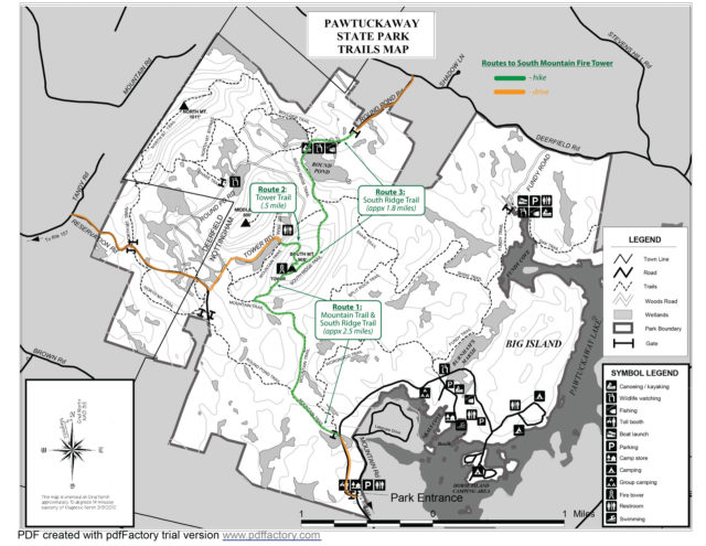
There are multiple routes for hiking up to the South Mountain fire tower, three of which are highlighted below. You can find the trails mentioned in this blog and many others on the Pawtuckaway Trail Map. Below is a highlighted version of the map with my 3 suggested routes highlighted.
Route 1: Mountain Trail to South Ridge Trail
One of the most popular South Mountain hiking routes is via Mountain Trail. This is the only trail leading to the fire tower that starts inside the main park. The trail head is located right off the park road, about a quarter mile from the park office/parking lot. The trail winds for a bit before intersecting with Round Pond Trail – stay right here and continue on Mountain Trail for another mile or so.
Eventually you will meet up with South Ridge Trail (trail sign has it labeled as Tower Trail), which will take you the last 0.6 miles up to the top of South Mountain and the fire tower. This is the steepest part of the climb as you will ascend several hundred vertical feet in just over half a mile. The hike on Mountain Trail totals just over 5 miles round trip and takes about 2-3 hours, depending on your hiking level and how much time you choose to spend enjoying the gorgeous views of the surrounding area.

Route 2: Tower Trail
You can also access a trail via Tower Road, which is reached from Reservation Road on the back side of the park. Tower Road is a bumpy, dirt road, so use caution when driving on it. The road brings you to a dirt parking lot where the trail up to the fire tower starts. This trail is much shorter, less than half a mile to the top, but is only marginally less steep than the other trails leading to South Mountain. However if you are looking to get some good views without putting in a lot of effort, this is the best option.

Route 3: South Ridge Trail
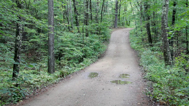
The final route up to South Mountain is on the South Ridge Trail. This trail head is reached from Round Pond Road off of Deerfield Road. The trail circles around Round Pond before climbing up the south ridge of the mountain. This is the least strenuous option in terms of steepness of the trail, and is a about 4 miles round trip.

Sunset at the top of South Mountain
No matter which route you choose to get to the top of South Mountain, the views are unbeatable in southeastern New Hampshire. From the fire tower you get full 360 degree views of the surrounding forests and an excellent view of Pawtuckaway Lake. There is plenty to see from the ground as well, with bird feeders attracting all sorts of birds to the exposed granite peak.

For more detailed information on how to get to any of the trail heads be sure to stop into the Pawtuckaway State Park office before you head out on your hike, and always bring good hiking shoes and plenty of water with you. So what are you waiting for? Let’s go hiking!


“3 Ways to Summit South Pawtuckaway” would be a better title.
SEO wise calling it South Mountain will bury this post so hikers will never be able to find it.