Franconia Notch State Park – July 15, 2011
The eight scenic miles along I-93 that make up Franconia Notch State Park are packed full of exciting adventures for visitors all year long. A variety of trails, scenic areas, historical sites, and natural wonders will make anyone’s visit a memorable one.
Sitting beneath the imposing Kinsman and Franconia mountain ranges the park offers more opportunities for hikers than you could ever imagine. From easily accessed paved paths to moderate family hikes or multi-day climbs to the higher summits, it’s easy to find a suitable trail for everyone at Franconia Notch State Park.
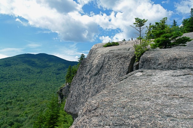
With an early start, I began my day at Franconia Notch in the very north of the park by scrambling up a quick trail to Artist’s Bluff. Rightfully named, the granite ledges at Artist’s Bluff are perched just above Echo Lake with an amazing view staring directly south back into the notch. Taking in the morning view I grabbed a seat on the rock ledges and could hear the first swimmers of the day jumping into the water down at Echo Lake. As the sun started to break through the clouds, I made my way down the rock staircases that form most of the trail to Artist’s Bluff.
I collected my car and moved south toward Profile Lake and the Old Man of the Mountain Plaza. While the Old Man may be gone, the views from Profile Lake are definitely not. While walking along the paved path down to the lake the sheer face of Eagle Cliff and the summits of Mount Lafayette and Mount Lincoln seem to stand straight above you. Further down, sitting on the benches at the edge of Profile Lake, it’s easy to see where the Old Man’s profile once hung out above the notch.
I relaxed for a short time along Profile Lake before once again heading south, this time stopping right along the Pemigewasset River to check out The Basin. Following the path from the parking area, I quickly realized that The Basin wouldn’t be the only thing to check out here. Fed by winter snowmelts and aided by the steep elevation of the notch, the Pemigewasset River has worn the bedrock into a smooth cascading stream that bounces around huge glacial boulders before falling into The Basin. Flowing from a small waterfall and swirling below, the Pemigewasset River has been working 25,000 years to erode a thirty-foot wide pothole known as The Basin. The deep blue, fifteen-foot hole is a geologic wonder and extremely unusual in an area where the river is quite shallow everywhere else.
I ventured past The Basin to join the one-mile hiking trail that follows along the Cascade Brook. The trail sticks close by the brook ascending several cascades, a few small waterfalls, and smooth rock ledges with views that look out to the Franconia Range. Reaching the top of the trail I sat to have lunch in the cool mist of Rocky Glen Falls. While heading back to the parking area I stopped at The Basin once more to try and makes sense of what Henry David Thoreau once called the “most remarkable curiosity of its kind in New England.”
After leaving The Basin, my next stop was Mount Pemigewasset. From the north part of the Flume parking area, the Mount Pemigewasset Trail crosses under I-93 before climbing one and half miles to the top of Mount Pemigewasset. Traversing the first part of the trail I crossed several wooden walking bridges that kept my feet dry and up above the small creeks running down the side of the mountain. After a steady climb through the woods, I made my way to the summit. Out of the trees, the granite peak drops straight down from the edge and leaves you with some very precarious views down to the valley below.
I wound my day up at Franconia Notch State Park, watching the sunset from atop of Mount Pemigewasset. The only thing I could have wished for was a few more hours of daylight. There is just so much to do, see and explore here that I could happily spend all summer in Franconia Notch State Park.

