A Leaf-Peeping Bike Ride Through Franconia Notch
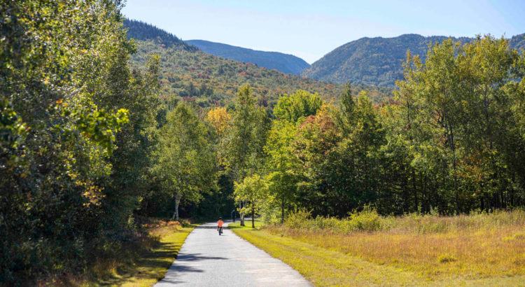
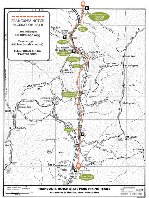
Biking down the Franconia Notch Recreation Path is one of the best ways to see fall foliage while also taking in the natural wonders and attractions of the notch. This paved bike path runs from Skookumchuck Trailhead all the way down to the Flume Gorge Visitor Center, passing Governor Gallen Memorial (Sunset Bridge), Echo Lake Beach, Old Man of the Mountain Profiler Plaza, Cannon Mountain Aerial Tramway, Lafayette Place Campground, and The Basin. Along the way there are spectacular views of the Kinsman Range, Franconia Range and Pemigewasset River. Several bridges, highway underpasses and picnic areas offer additional points of interest. From end to end the trail is about 9 miles with roughly 800 feet in elevation change, so consider arranging for a pick-up or drop off at one of the points if you aren’t up for the full 18 mile down and back ride.
Watch a video of this bike ride on NH State Parks Instagram
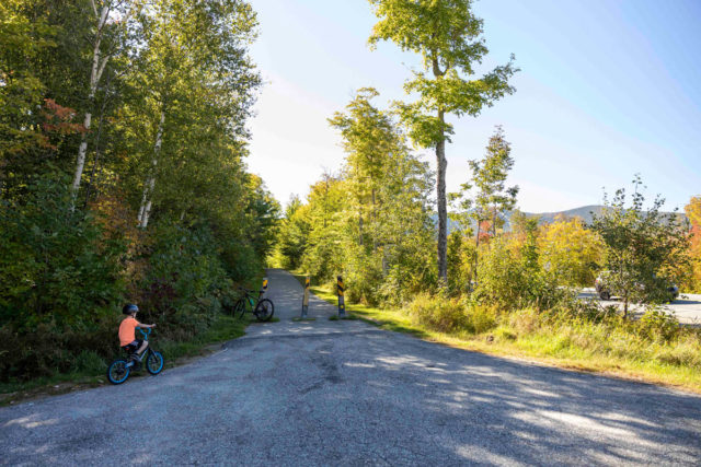
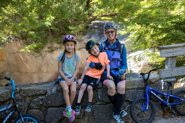
NOTE: For the trip highlighted below (a kid-friendly version) we used 2 cars. One car was parked at the Flume Gorge and the other we drove north to the Skookumchuck Trailhead to start our ride. Riding the trail from north to south is more downhill (although there are still a few climbs) making it easier for kids to join in. Riding in just one direction also gave us extra time to explore the Flume Gorge at the end of our ride.
Franconia Notch Recreation Path – Trip Details:
- Parking: The trail starts/ends at the Skookumchuck Trailhead (exit 35 off 93) and the Flume Gorge Visitor Center (exit 34A). You can also access the bike path from many of the FNSP attraction parking areas including Echo Lake Beach, Cannon Tram, Profiler Plaza, Lafayette Place and The Basin.
- Distance: 9 miles (one way) or 18 miles for the complete down and back.
- Elevation change: about 800 feet
- Difficulty: Moderate (difficulty really depends on how much distance you want to do and where you start). The bike path is paved, flat doubletrack, however there are some hills to climb/descend that can be challenging. Riding the route northward will be more uphill and riding the route southward is more downhill.
- Maps: Franconia Notch State Park Hiking Map | Map of FNSP Attractions
We started at the Skookumchuck Trailhead off of exit 35 and rode the path southward. The leaves had only just started to change in the Notch (late September, 2021) and colors tends to peak here just before the middle of October. See the VisitNH Foliage Tracker to help time your visit for maximum leaf-peeping experience.
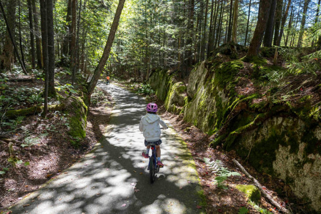
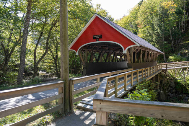
The trail starts out pretty flat with a few gradual inclines and gentle downhills. It passes over Skookumchuck Brook before reaching our first stop – Sunset Bridge (Governor Gallen Memorial). Here, there are some excellent views of Mount Lafayette and down into Lafayette Brook. From the bridge you can look down over 1-93 and some coin operated binoculars offer a magnified view of the mountains to the northeast.
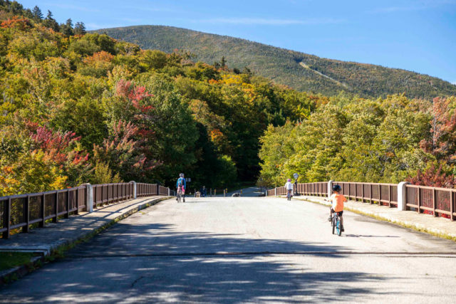
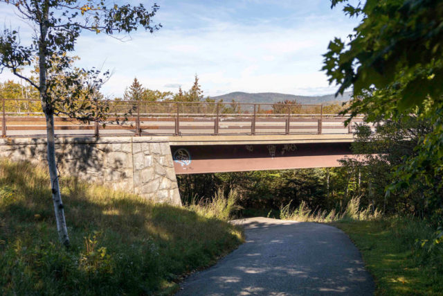
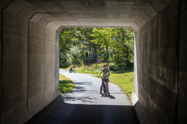
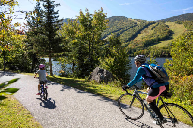
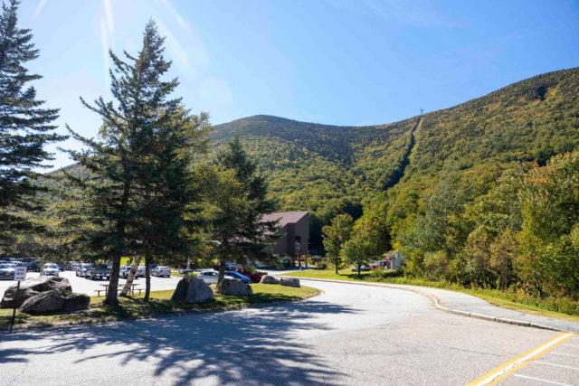
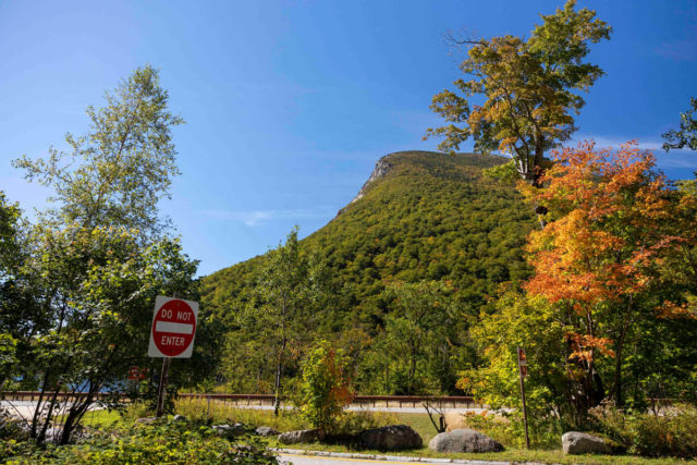
Bear right after Sunset Bridge and follow the bike path as it travels under the highway. Soon you’ll see the rocky face of Artists Bluff on the right and then the slopes of Cannon Mountain. After a gradual climb you’ll go through a cool little underpass tunnel beneath Route 18 and come up quickly to Echo Lake. You’ll see the beach area on your right and get some excellent views of Cannon’s ‘Front 5’ trails as you continue alongside Echo Lake.
After you pass Echo Lake, the trail comes up next to the highway and then crosses the road at the entrance for the Cannon Mountain Aerial Tramway. The New England Ski Museum is right next door to the Tram and has some incredible old films, photos and artifacts telling the story of our alpine heritage if you have time for a quick stop.
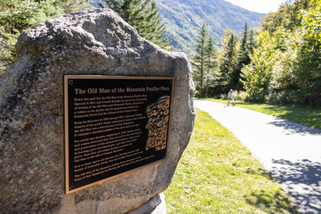
After passing the Tram you’ll quickly arrive at the Old Man of the Mountain Profiler Plaza (Note: this is a bike-walk zone). The bike path actually turns left and goes through another highway underpass just before Profile Lake, but if you have time, walk down to Profiler Plaza to see where the Old Man once stood and check out the installment of viewing columns that re-imagine what the view used to be.
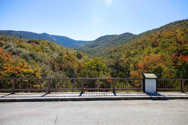
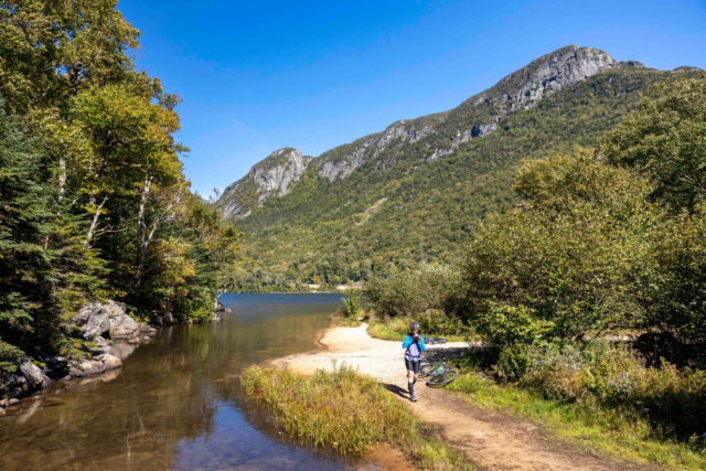
On the other side of the highway underpass from Profiler Plaza is a little cascade and pond with some more views across the highway of the Cannon Cliffs. The trail enters the shade of the forest, passes over a bridge and some rolling hills and then veers right again and back underneath the highway. After passing under I-93 again you’ll see Profile Lake to the right. The bike path heads left, crossing the Pemi Trail and another bridge over the Pemigewasset River.
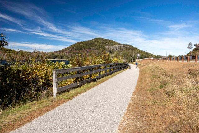
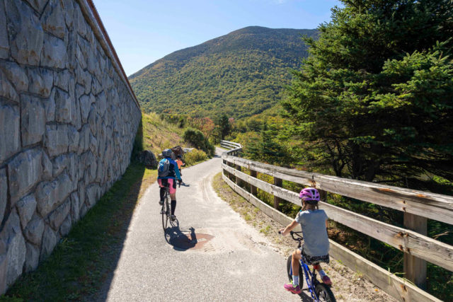
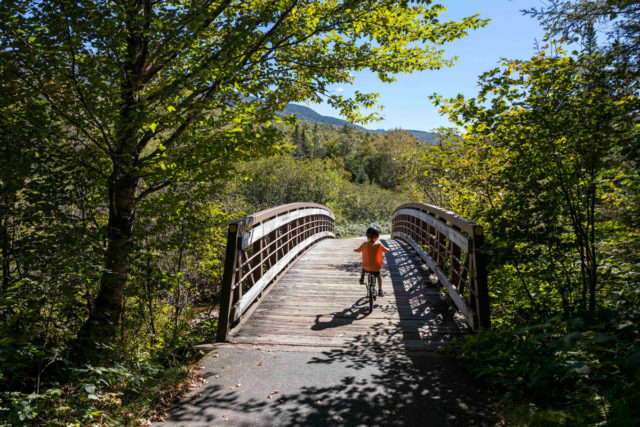
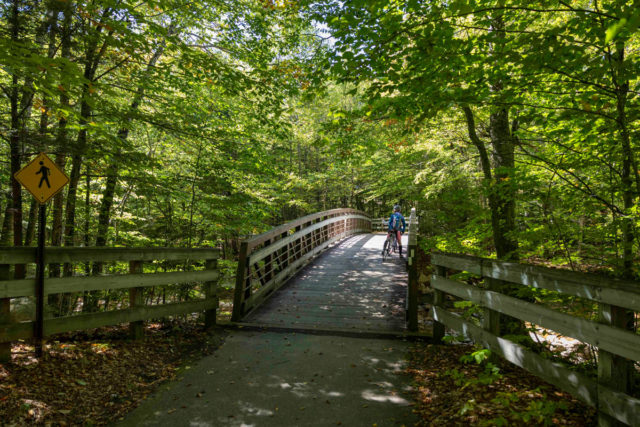
Continue following the recreation path as it enters the woods and travels up and over a few rolling hills before coming to another really cool bridge just before Lafayette Place Campground. Here the trail opens up and there are some excellent views across to Mount Liberty, down into the small stream, and then back towards the Cannon Cliffs after you cross.
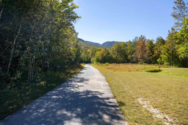
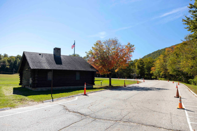
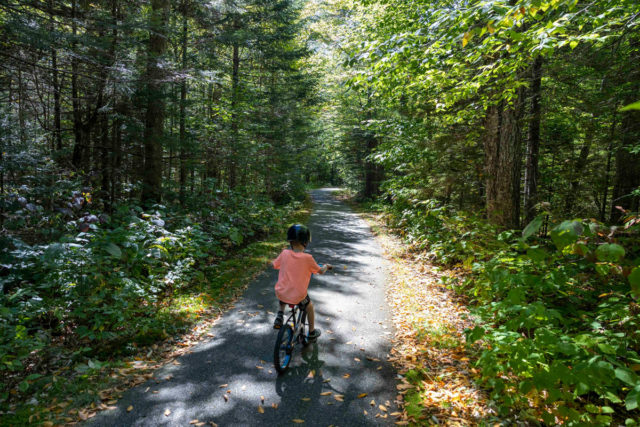
Lafayette Place Campground and the Hiker Information Cabin are just a short distance after the bridge. The bike path then continues along the edge of the Pemigewasset River after the Lonesome Lake Trailhead. The kids really enjoyed this section of the trail because it is all downhill and winds along the Pemigewasset River providing peeks into the rushing water below.
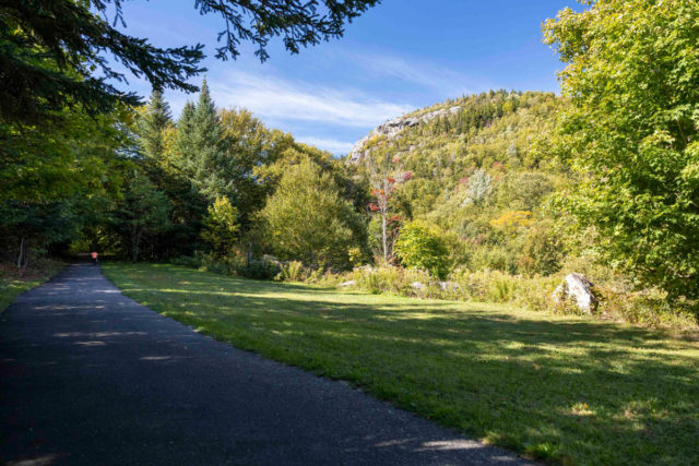
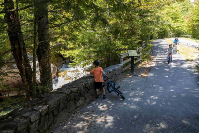
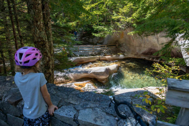
Another 2 miles down from Lafayette Place you’ll come to The Basin. There is a little trailside pull-off spot to view the Basin right from the bike path, but you may also want to spend some additional time here walking down the trail to check out all the amazing rock formations and cascades this area affords before continuing your ride.
The bike path stays next to the river for about another 1/4 of a mile before dipping under the highway again and continuing southward towards the Flume. It is another 2 miles down the trail to get to the Flume Gorge and the trail climbs and descends a few more hills in this section.
This section is mostly down hill as well and the kids coasted along casually. There are a few more small bridges, including another really interesting one back over the Pemi that provided a good look down into the river and a view of the mountains northward.
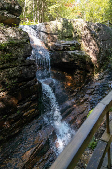
The Flume Gorge
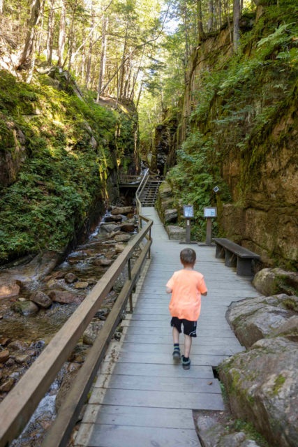
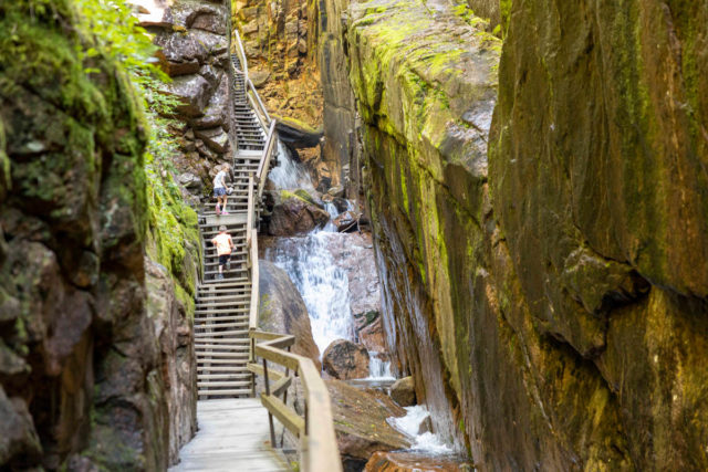
A little further down from the bridge the trail finally comes to an end at the Flume Gorge parking lot. Once here, park your bikes and take the time to walk up and see one of NH’s most spectacular natural wonders. The Flume Trail is currently a one-way, 2-mile loop starting at the check-in booths located in front of the Flume Building.
The entire loop takes approximately 1.5 hours and finishes at the Flume Gorge Visitor’s Center. The walk includes uphill walking and lots of stairs. The boardwalk allows you to look closely at the growth of flowers, ferns and mosses found here.
NOTE: Unless you planned ahead to have someone pick you up (or you brought 2 cars) remember that you still need to travel almost 9 miles back up to your car and the ride northward is mostly uphill. Make sure you mare prepared in this event and plan accordingly.
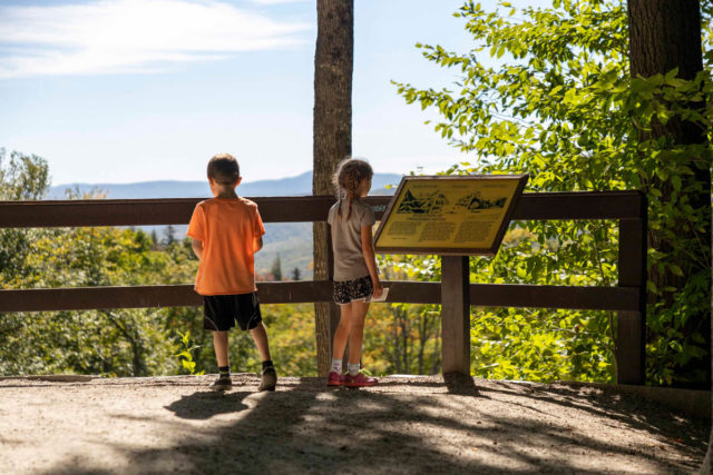
Even after the 9 mile ride the kids seemed to be re-energized by the walk through the gorge. They also loved all the interpretive signs along the way along with the plant identification that that were scattered throughout the trail.
At the time of this visit in late September the colors of fall were only beginning to emerge. If you want to maximize your leaf-peeping efforts while travelling to Franconia Notch State Park, plan your trip for the beginning of October. Check out the VisitNH Foliage Tracker for status updates as well.