There are more than 10 waterfalls in and around Crawford Notch State Park. So, we wondered – how many could we hike to in a single day? For us the magic number was 8 – but for others it might be more or less. Since an adventure like this may take the better part of a day – if you’re planning to try it yourself – you might want to reserve a campsite at Dry River Campground before setting out.
The blog post below describes how we managed to hike to 8 Crawford Notch waterfalls in one day:
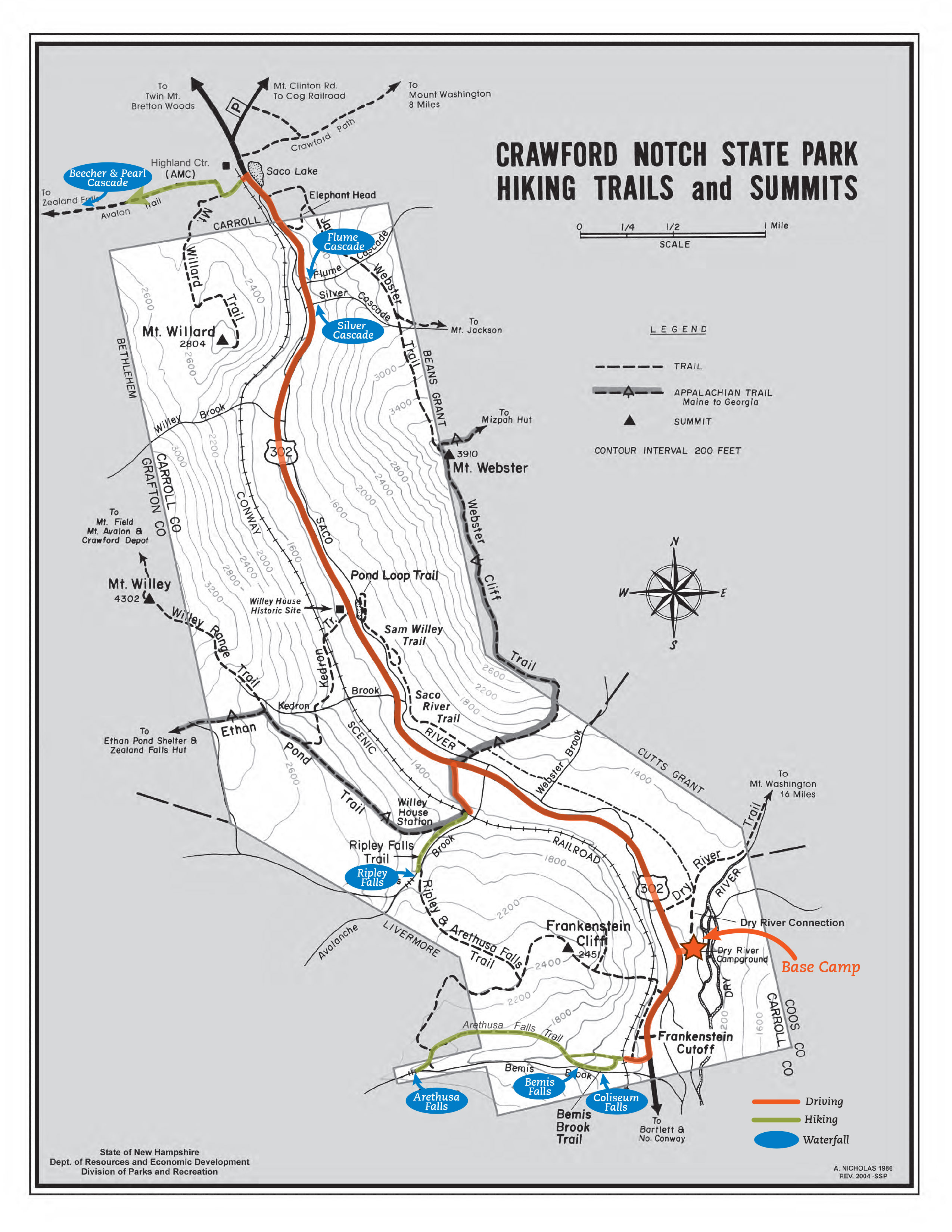
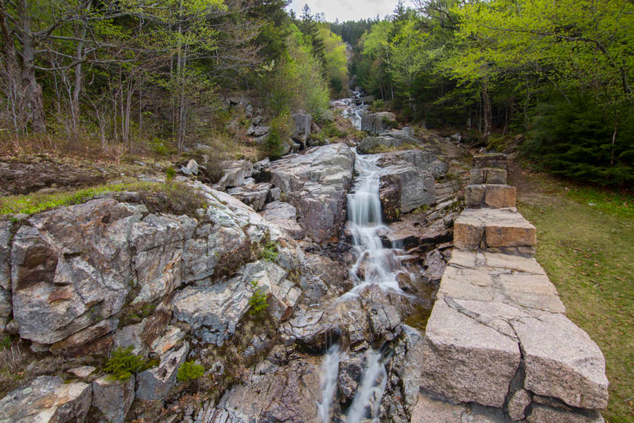
#1: Coliseum Falls
Hiking Distance: .25 mi (one way via Bemis Brook Trail)
Hiking Time: 12 minutes
Start off on Arethusa Falls Trail and bear left at the trail junction to follow Bemis Brook Trail. The trail closely parallels Bemis Brook. You’ll pass Fawn Pool and come up quickly on Coliseum Falls. Terrain is fairly easy on this first section of the trail.
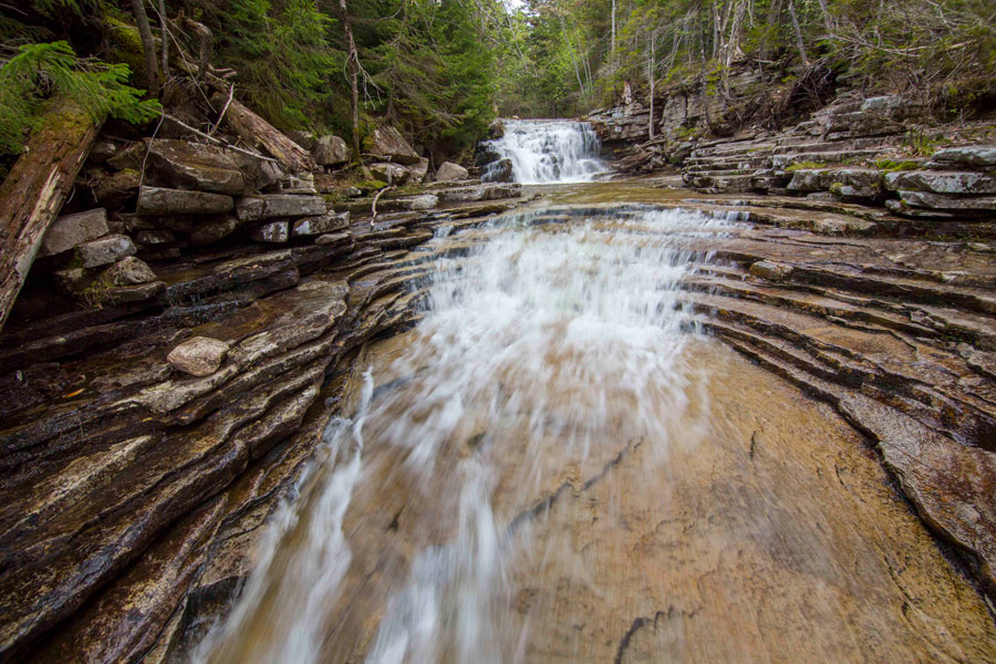
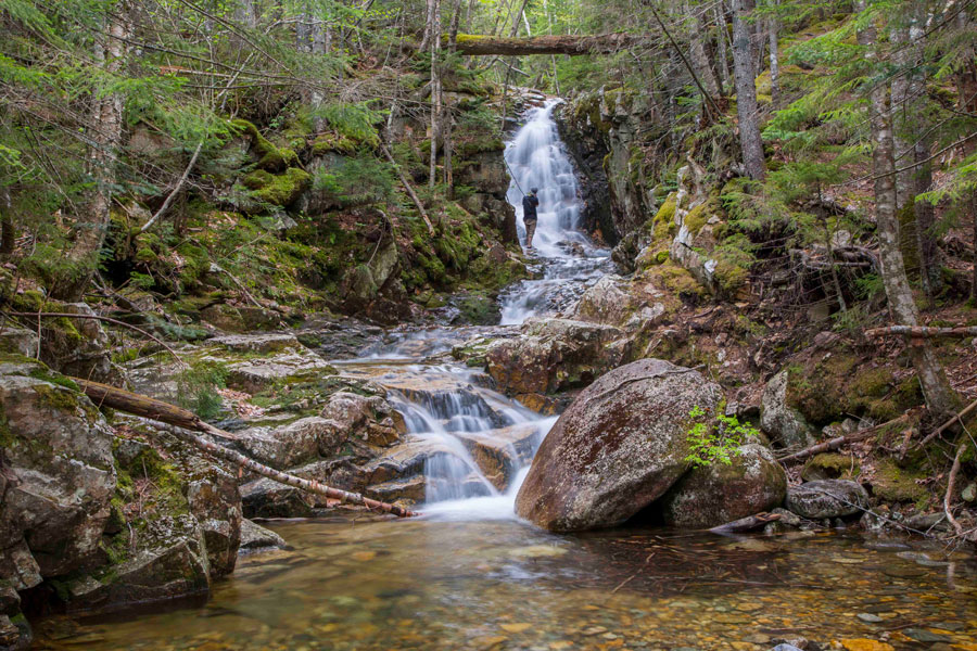
#2: Bemis Falls
Hiking Distance: .5 miles (one way via Bemis Brook Trail)
Hiking Time: 25 minutes
Continue on Bemis Brook Trail for another quarter of a mile until you get to Bemis Falls. The trail starts to become more rocky/rooty and challenging on this section of the trail.

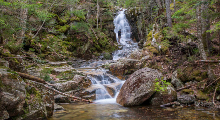
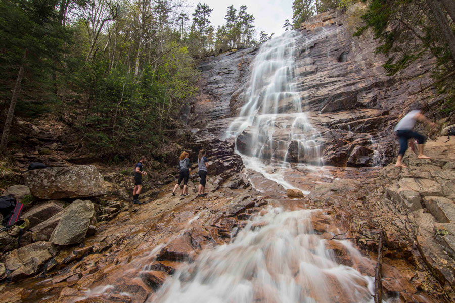
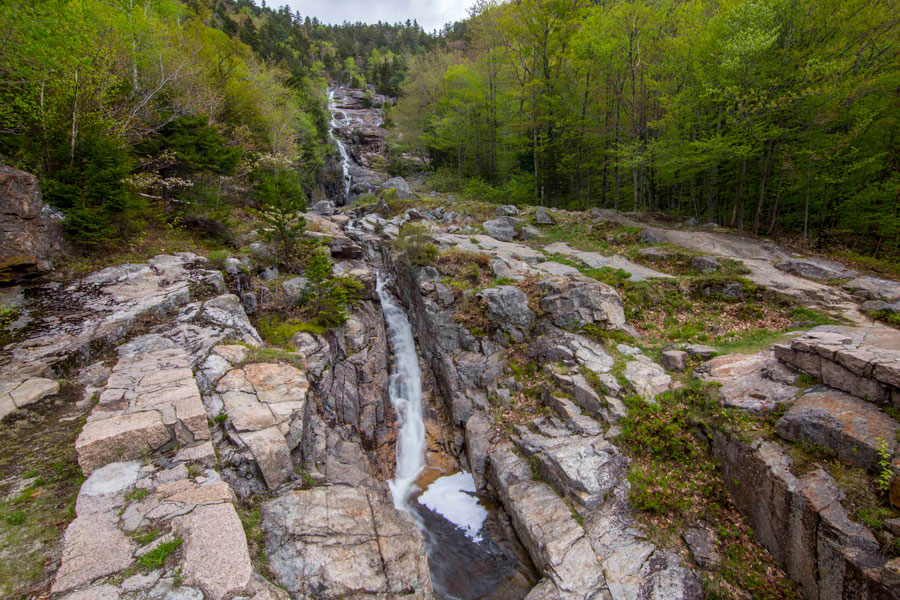
#3: Arethusa Falls
Hiking Distance: 1.6 miles (one way via Bemis Brook/Arethusa Falls Trail)
Hiking Time: 50 minutes
After Bemis Falls, the trail becomes very steep and challenging for a few hundred yards. The terrain levels off a bit after connecting again with the Arethusa Falls Trail. From the trail junction it’s about a mile hike on moderately difficult terrain to reach Arethusa Falls. Return via the Arethusa Falls Trail for a less difficult descent.
#4: Ripley Falls
Hiking Distance: .5 mi (via Ripley Falls Trail)
Hiking Time: 20 minutes
From the Arethusa Falls Trailhead drive north on Rt 302 for about two and half miles until you see the sign for Ripley Falls. Turn left and follow the road to the parking area for Ripley Falls Trail and Ethan Pond Trail. From the parking area Ripley Falls is about a half mile hike up moderately difficult terrain.

#5: Silver Cascade
Hiking Distance: 0 miles (parking is available across the street) (you can hike around on the ledges next to the falls if desired)
Hiking Time: 0 minutes (located right off of Rt. 302)
From Ripley Falls trailhead drive north on Rt 302 for about three and a half miles. When you approach Silver and Flume Cascade you’ll see two parking areas for viewing the falls on the left side of the road – pull off and park there. You can walk across Rt 302 and access both of these falls from there.
#6: Flume Cascade
Hiking Distance: 0 miles (parking is available across the street) (you can hike around on the ledges next to the falls if desired)
Hiking Time: 0 minutes (located right off of Rt. 302)
From Ripley Falls trailhead drive north on Rt 302 for about three and a half miles. When you approach Silver and Flume Cascade you’ll see two parking areas for the falls on the left side of the road – pull off and park there. You can walk across Rt 302 and access both of these falls from there.
#7: Beecher Cascade
Hiking Distance: .5 mi (take Avalon Trail to Cascade Loop)
Hiking Time: 20 minutes
From Silver and Flume Cascade drive north on Rt 302 for about a mile until you reach Crawford Depot. There is some parking available at Crawford Depot and more hiker parking further up the road if needed. Start off on the Avalon Trail (right behind Crawford Depot) and after about a quarter of a mile you’ll see a sign for the Cascade Loop. Turn left here and follow the trail for another quarter mile until you see the sign for Beecher Cascade. The terrain starts out rather easy and gets moderately difficult when you get closer to the falls.

#8: Pearl Cascade
Hiking Distance: .6 mi (follow Avalon Trail to Cascade Loop)
Hiking Time: 25 minutes
Pearl Cascade is just a short walk up the trail from Beecher Cascade. Follow the Cascade Loop Trail until you see the sign for Pearl Cascade.
If that’s not enough – here are a few other waterfalls in/around Crawford Notch: Kendron Flume (follow the Kedron Trail .75 mi), Gibbs Falls (follow Crawford Path .6 mi), Nancy Cascade (located a little south of the Notch – follow Nancy Pond Trail 2.4 mi).
Once you’ve had your fill of falls – head back to Dry River Campground and relax next to a nice campfire!

Wonderful time hiking Arethusa Falls with a dear friend many moins ago!
Hi!
This is so helpful! Thank you for creating this. ? for you. We will be going next week….do you think the waterfalls are still flowing since it is July?
Perfect information, Thanks! We take in several waterfall hikes every year for the beauty and so I can paint them. Thompson Falls at Wildcat are also very nice but can be a bit crowded.
We are often on the hunt for short easier hikes with great views for us aging ones.