02.09.13 *UPDATE*
What I am certain will be known as the “Blizzard of ’13” here in New England has finally come to an end. The winds have remained heavy this evening, but the snow halted in the mid afternoon.
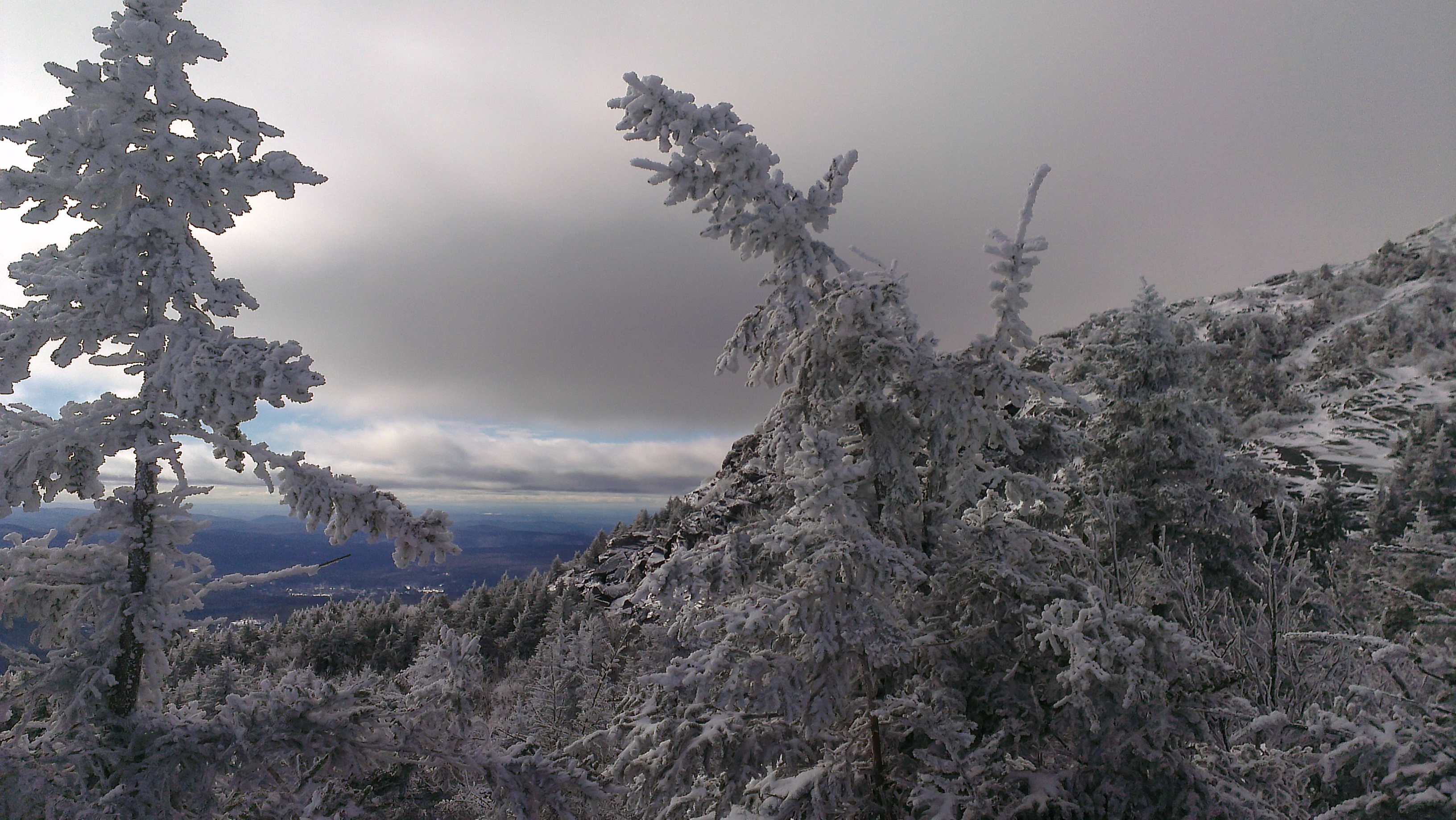
Due to the wind and constantly drifting snow throughout the storm, it is a challenge to get a precise accumulation total. All in all, I would say that Mt. Monadnock was blanketed with about 32″ of new snow.
A very few hardy folk came in to hike today; mostly “regulars”. Most hikers, especially in the morning on Sunday, will more or less be breaking trail, or at least feel like they are, despite today’s light trail traffic.
With the high winds that continue to gust tonight, the snow depths will vary on Monadnock, especially above treeline. Some drifts are 4-5 feet deep.
Sunday looks like a beautiful day to hike; mostly sunny with temps at the base reaching into the mid 20’s. Winds could remain gusty in the morning. Depending on your planned route, snowshoes and light spiked traction will be helpful. Waterproof insulated boots, snow pants or thick hiking pants, eye protection, and layers will be necessary.
There is plenty of snow for X-C skiing now, as expected.
Monday looks to bring some mixed precipitation and rain into the Monadnock Region before clearing out for what sounds like a favorable rest of the week at this point in the forecast.
Remember, access to “back trails” on Monadnock may be restricted or completely unavailable due to the storm. The Monadnock HQ parking lot is plowed out, but until DOT is able to wing and treat Poole Road, vehicle access up into the Park may be limited for those with 2 wheel drive on Sunday.
The most up-to-date information can always be found by calling us directly at 603-532-8862.
I hope you all fared the storm well. I’ll be back to check in on Friday.
-Patrick
02.08.13
“…an old ring-tail snorter of a snow storm…”- George Lang, Stratham, NH, February, 1893.
George Lang is quoted there describing a New England Nor’Easter similar to the one that has already arrived here at Monadnock State Park. Initial estimates from the National Weather Service called for snowfall in our part of the state of anywhere between 1-2 feet.
More recent estimates are now saying that the Monadnock Region could see upwards of 33 inches of snow by the time this storm wraps up tomorrow afternoon. Even conservative low estimates are calling for at least 19″ of new snow in total.
The snow has been lightly falling all day, but the storm has picked up steam this afternoon. Winds at the summit are now gusting to over 80 mph and wind chill values are near 30 below.
Due to extreme winter conditions with concerns about low visibility, high winds, cold temperatures, and rapid snow accumulations, hikers are discouraged from venturing above treeline through Saturday morning, at least. Wind chill values will remain well below zero on Saturday, even after the snow tapers off. Hikers need to be well prepared and equipped for any type of hike on Saturday. The mountain may be closed, so call and check with staff prior to traveling Saturday.
With the high winds expected to accompany the storm, we should see varying snow depths and deep drifts above treeline.
For reminders about winter hiking/climbing safety, check out Mt. Washington State Park Manager Mike Pelchat’s informative blog entry from earlier this week:
http://blog.nhstateparks.org/expect-the-non-expected/
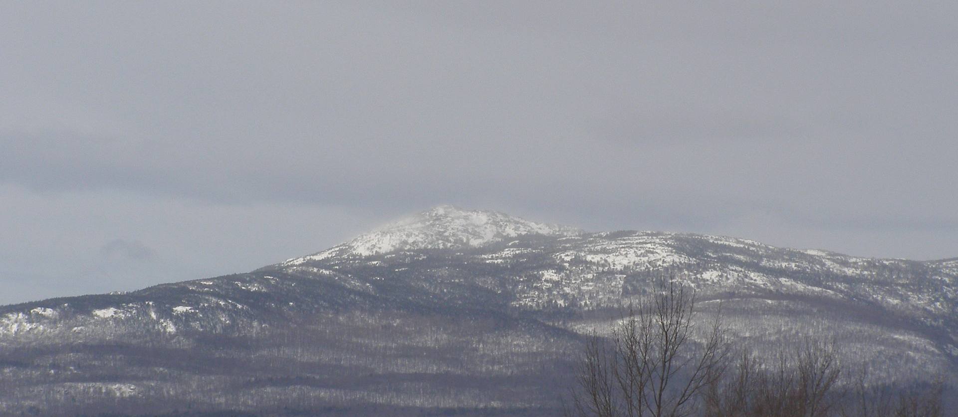
Mt. Monadnock may not have the intimidation factor or severe reputation of New Hampshire’s higher peaks, but due to its geographic isolation, Monadnock often behaves like a much taller mountain and can experience severe weather patterns, changes, and conditions. In my time here, I have experienced -3o wind chills, 90+ mph winds, disorienting low visibility, extreme ice accumulation, and snow drifts taller than myself, at one time or another. Monadnock is a tougher and more dangerous mountain than it gets credit for.
The weather should clear by Sunday, which looks like a much safer and enjoyable time to venture out of the house and visit Monadnock. Sunday may offer a small window of winter hiking delight as the beginning of next week could bring some warmer temperatures at times and mixed precipitation, including some possible rain.
Access to “back trails” will be limited or unavailable after this whopper of a storm. The Monadnock HQ area at the base of the White Dot Trail is the only trailhead maintained by Park Staff through the winter.
A combination of snowshoes and light spiked traction will be needed for a successful trip to the mountain following this Nor’Easter, in addition to the rest of your winter hiking gear. Monadnock’s trails will take some time to become packed down.
Nordic skiing may be possible after this one storm. If you plan to X-C ski on Monadnock’s 8+ mile ungroomed network, call the Park directly to ensure favorable conditions before arriving.
Check back on this blog entry for a post-storm update before next Friday’s scheduled posting.

New England Nor’Easters
“Nor’Easters” have given us some of the most noteworthy winter storms in New England’s history. These slow moving, counter-clockwise spinning storms are highlighted by north east winds in the west side of the cyclone, giving the storms their “Nor’Easter” moniker.
While they are not the same thing, blizzards often occur within Nor’Easters. Blizzards usually contain some or all of the following factors: winds of 35 mph or greater, reduced visibility to less than 1/4 of a mile, snow accumulations of 10 inches or more, and temperatures of 20 degrees or less. This current storm looks like it will contain nearly all of those blizzard qualities.

Let’s take a look at some of the notable historic Nor’Easters that have slammed Mt. Monadnock and the rest of New England.
The Great Snow of 1717
The first recorded ascent of Mt. Monadnock didn’t occur until 8 years later, so there isn’t any information of how these storms affected the mountain or the Region. We know there was a series of four storms from February 27 through March 7. Accumulations from these storms reached 40″ in Boston and up to 5 feet in areas north of Boston. Snow drifts reportedly stacked up between 15-20 feet in some parts of New England!
The Blizzard of ’88
This event occurred during the Grover Cleveland Administration (Round 1), not the Reagan White House. New England’s most famous winter storm, also known as “The Great White Hurricane”, hit on March 12th, 1888 and wreaked havoc on the north east. When the storm came to an end two days later, many areas of western New England ended up with over 40″ of snow. Saratoga Springs, NY, topped the charts with 58″ of snow.
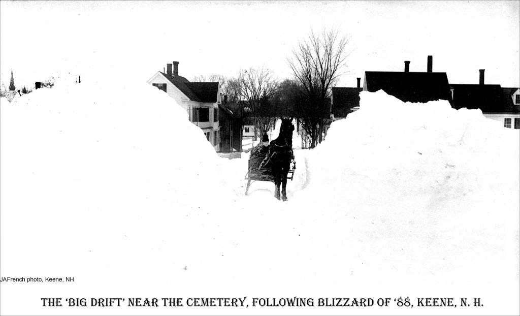
Dublin, NH, received the highest snowfall total in New Hampshire from this Nor’Easter. The picturesque town on the north side of Mt. Monadnock collected 42″ of snowfall!
The Pumpelly Trail, the second of the two trails leading up Monadnock on the Dublin side of the mountain, had only been opened four years earlier. Abbott Thayer, Monadnock’s most famous painter and outspoken advocate, arrived in Dublin for the first time later that summer.
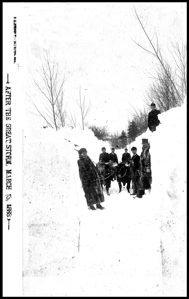
The Blizzard of ’78
Some of you may recall the blizzard of 1978. It was 35 years ago, on February 7th and 8th, that this hallmark storm barreled into New England. This explosive storm was noted for its intensity, which caught many forecasters off-guard. Estimates of more than 40″ of precipitation fell in Rhode Island with a record 27.6″ of snow in Providence. Snow drifts as high as 10 feet were reported in Boston and a record total of 27.1″ of snow fell in Bean Town.

Snow totals were a bit lighter at Mt. Monadnock, but still noteworthy, with about 28″ of snow. Ben Haubrich, who was Park Manager at the time, remembers being snowed-in at the Manager’s Residence with no electricity. It would be 3 days before the State plow trucks would open up Poole Road and the electricity would come back on following the storm.

Will we add “The Blizzard of 2013” to this list? We’re about to find out…